place

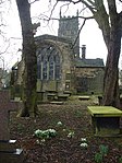
St James' Church, Midhopestones

14th-century church buildings in EnglandChurch of England church buildings in South YorkshireChurches in SheffieldGrade II* listed buildings in SheffieldGrade II* listed churches in South Yorkshire
History of SheffieldTourist attractions in SheffieldUse British English from March 2018
St James church, Midhopestones

St James’ Church, Midhopestones is situated in the small rural hamlet of Midhopestones, just within the northern boundary of the City of Sheffield in South Yorkshire. Since April 1969 it has been a Grade II* listed building. St James is small church which is often referred to as a chapel, in fact it is situated on Chapel Lane. The church is officially dedicated to James the Less and not James the Greater although there has always been some confusion. Some modern historians and clergy maintain that the church should be dedicated to James the Greater as the scallop shells carved above the church door are the traditional emblem of James the Greater. It is possible that it was re-dedicated to James the Less in the Victorian era because of the smallness of the church. The church is in the Parish of Penistone within the Diocese of Wakefield.

Excerpt from the Wikipedia article St James' Church, Midhopestones (License: CC BY-SA 3.0, Authors, Images).

St James' Church, Midhopestones
Chapel Lane, Sheffield Bradfield

Geographical coordinates (GPS) Address External links Nearby Places
placeShow on map

Wikipedia: St James' Church, MidhopestonesContinue reading on Wikipedia

Geographical coordinates (GPS)

Latitude Longitude
N 53.492 ° E -1.6473 °
placeShow on map

Address

St James - Midhope

Chapel Lane
S36 4GP Sheffield, Bradfield
England, United Kingdom
mapOpen on Google Maps

linkWikiData (Q7593445)
linkOpenStreetMap (288772737)

St James church, Midhopestones
Share experience

Nearby Places

Penistone
Penistone

Penistone ( PEN-iss-tən) is a market town and civil parish in the Metropolitan Borough of Barnsley, South Yorkshire, England, which had a population of 22,909 at the 2011 census. Historically in the West Riding of Yorkshire, it is 8 miles (13 km) west of Barnsley, 17 miles (27 km) north-east of Glossop, 14.2 miles (23 km) north-west of Sheffield, 27 miles (43 km) south-west of Leeds and 29 miles (47 km) east of Manchester in the foothills of the Pennines. The town is frequently noted on lists of unusual place names. The highest point, Hartcliffe Tower, is 1,194 ft (364 m) above sea level and has views over the Woodhead bypass and the Dark Peak. The surrounding countryside is predominantly rural with farming on rich well-watered soil on mainly gentle slopes rising to the bleak moorland to the west of the town. Dry stone walls, small hamlets and farms surrounded by fields and livestock are synonymous with the area. The area is known for its rugged breed of sheep, the Whitefaced Woodland. The market town itself stands at its highest point around St Johns Church at around 820 ft (250 m) above sea level. However, the surrounding land rises well over 1,000 ft (300 m) towards Cubley and Thurlstone Moors and out towards smaller hamlets at Carlecotes, Victoria, Dunford and Crow Edge, elevated at points above 1,200 ft (370 m). There are several vantage points around Penistone that afford panoramic views of the surrounding areas of West Yorkshire and North Derbyshire.