place

Winterton Dunes

Coastal features of NorfolkDunes of EnglandNature Conservation Review sitesNorfolk geography stubsSites of Special Scientific Interest in Norfolk
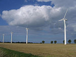
Winterton Dunes DSC00508

Winterton Dunes is an extensive dune system on the east coast of Norfolk, England, which has been designated as a National Nature Reserve of 109 ha. Winterton Dunes is within the Norfolk Coast AONB. The site is unusual in that it shows greater ecological similarities to the dune systems of the Baltic - which support acidic plant communities - rather than the dunes on the North Norfolk Coast - where the sand is calcareous. The site supports well developed areas of dune heath, wet 'slacks' between dunes and dune grassland which grades into grazing marsh and birch woodland.

Excerpt from the Wikipedia article Winterton Dunes (License: CC BY-SA 3.0, Authors, Images).

Winterton Dunes
Vichyplatz,

Geographical coordinates (GPS) Address Nearby Places
placeShow on map

Wikipedia: Winterton DunesContinue reading on Wikipedia

Geographical coordinates (GPS)

Latitude Longitude
N 52.7266 ° E 1.6873 °
placeShow on map

Address

Vichyplatz 1
83646
Bayern, Deutschland
mapOpen on Google Maps

Winterton Dunes DSC00508
Share experience

Nearby Places

The Broads
The Broads

The Broads (known for marketing purposes as The Broads National Park) is a network of mostly navigable rivers and lakes in the English counties of Norfolk and Suffolk. Although the terms "Norfolk Broads" and "Suffolk Broads" are correctly used to identify specific areas within the two counties respectively, the whole area is frequently referred to as the Norfolk Broads. The lakes, known as broads, were formed by the flooding of peat workings. The Broads, and some surrounding land, were constituted as a special area with a level of protection similar to a national park by the Norfolk and Suffolk Broads Act 1988. The Broads Authority, a special statutory authority responsible for managing the area, became operational in 1989.The area is 303 square kilometres (117 sq mi), most of which is in Norfolk, with over 200 kilometres (120 mi) of navigable waterways. There are seven rivers and 63 broads, mostly less than 4 metres (13 ft) deep. Thirteen broads are generally open to navigation, with a further three having navigable channels. Some broads have navigation restrictions imposed on them in autumn and winter, although the legality of the restrictions is questionable.The Broads has similar status to the national parks in England and Wales; the Broads Authority has powers and duties akin to the National Parks but is also the third-largest inland navigation authority. Because of its navigation role the Broads Authority was established under its own legislation on 1 April 1989. The Broads Authority Act 2009, which was promoted through Parliament by the authority, is intended to improve public safety on the water.