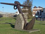
River Medway

The River Medway is a river in South East England. It rises in the High Weald, West Sussex and flows through Tonbridge, Maidstone and the Medway conurbation in Kent, before emptying into the Thames Estuary near Sheerness, a total distance of 70 miles (113 km). About 13 miles (21 km) of the river lies in East Sussex, with the remainder being in Kent.The Medway has a catchment area of 930 square miles (2,409 km2), the second largest in southern England after the Thames. The map opposite shows only the major tributaries: a more detailed map shows the extensive network of smaller streams feeding into the main river. Those tributaries rise from points along the North Downs, the Weald and Ashdown Forest.
Excerpt from the Wikipedia article River Medway (License: CC BY-SA 3.0, Authors, Images).River Medway
Garrison Road, Borough of Swale
Geographical coordinates (GPS) Address Nearby Places Show on map
Geographical coordinates (GPS)
| Latitude | Longitude |
|---|---|
| N 51.449166666667 ° | E 0.73833333333333 ° |
Address
Garrison Road
ME12 1BU Borough of Swale
England, United Kingdom
Open on Google Maps


