Acera
Frazioni of the Province of PerugiaUmbria geography stubs

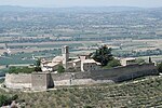
Acera is a frazione of the comune of Campello sul Clitunno in the Province of Perugia, Umbria, central Italy. It stands at an elevation of 972 metres above sea level. At the time of the Istat census of 2001 it had 19 inhabitants.
Excerpt from the Wikipedia article Acera (License: CC BY-SA 3.0, Authors, Images).Acera
Strada provinciale di Passo Spina,
Geographical coordinates (GPS) Address Nearby Places Show on map
Geographical coordinates (GPS)
| Latitude | Longitude |
|---|---|
| N 42.848611111111 ° | E 12.843055555556 ° |
Address
Strada provinciale di Passo Spina
Strada provinciale di Passo Spina
06049
Umbria, Italy
Open on Google Maps


