Loversall

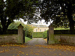
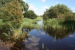
Loversall is a village and civil parish in the City of Doncaster in South Yorkshire, England. It has a population of 128, increasing to 156 at the 2011 Census.The village consists mainly of residential properties and farm buildings. There is also a popular children's nursery. Although there was once a village shop there are no shops currently located within the village. However, there is a major supermarket adjacent to Loversall Parish, within the development known as Woodfield Plantation. There are also a small number of shops and a Post Office in the adjacent village of Wadworth. Loversall Lakes (Quarry Farm) is a popular fishing facility and periodically the fields around Loversall are used for clay pigeon shooting. St Katherines Church is a Grade II* listed building. It appears to have been built before 1207 by the Fossard family, who owned the Manor of Hexthorpe under Count Robert de Mortain (half brother to William the Conqueror). Within the churchyard lies an early 14th-century tomb chest which is also Grade II* listed. Loversall Hall, next to the church, is a large but plainly-built house, its principal front built by the Fenton family of Leeds between 1808 and 1816, although the buildings at the rear are probably seventeenth century. Loversall was part of the manor of Doncaster, and its church, dedicated to St Katherine, was technically a chapel of ease in the parish of Doncaster, rather than a fully-fledged parish church. There are a number of working farms in the Parish, including Quarry Farm adjacent to the A60 and Loversall Farm, the farmhouse for which is located within the village. Pear Tree Farm, also within the village, is no longer a working farm but the farmhouse, thought to be around 250 years old, remains in residential use.
Excerpt from the Wikipedia article Loversall (License: CC BY-SA 3.0, Authors, Images).Loversall
Bubup Hill, Doncaster Loversall
Geographical coordinates (GPS) Address Nearby Places Show on map
Geographical coordinates (GPS)
| Latitude | Longitude |
|---|---|
| N 53.481111111111 ° | E -1.1363888888889 ° |
Address
Bubup Hill
Bubup Hill
DN11 9DD Doncaster, Loversall
England, United Kingdom
Open on Google Maps


