Dolní Krupá (Havlíčkův Brod District)
Pages with Czech IPAVillages in Havlíčkův Brod DistrictVysočina Region geography stubs

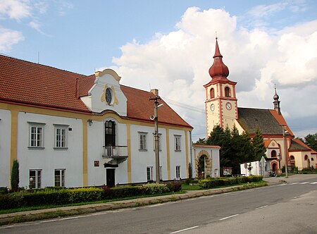
Dolní Krupá (Czech pronunciation: [ˈdolɲiː ˈkrupaː]; German: Unter Kraupen) is a municipality and village in Havlíčkův Brod District in the Vysočina Region of the Czech Republic. It has about 400 inhabitants. Dolní Krupá lies approximately 7 kilometres (4 mi) north of Havlíčkův Brod, 30 km (19 mi) north of Jihlava, and 98 km (61 mi) south-east of Prague.
Excerpt from the Wikipedia article Dolní Krupá (Havlíčkův Brod District) (License: CC BY-SA 3.0, Authors, Images).Dolní Krupá (Havlíčkův Brod District)
344, okres Havlíčkův Brod
Geographical coordinates (GPS) Address Phone number Nearby Places Show on map
Geographical coordinates (GPS)
| Latitude | Longitude |
|---|---|
| N 49.660555555556 ° | E 15.603055555556 ° |
Address
Dolní Krupá
344 30
582 71 okres Havlíčkův Brod, Dolní Krupá u Havlíčkova Brodu
Czechia
Open on Google Maps


