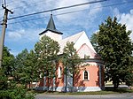
Slapy (Tábor District)
South Bohemian Region geography stubsVillages in Tábor District

Slapy is a municipality and village in Tábor District in the South Bohemian Region of the Czech Republic. It has about 500 inhabitants. Slapy lies approximately 5 kilometres (3 mi) south-west of Tábor, 47 km (29 mi) north of České Budějovice, and 79 km (49 mi) south of Prague.
Excerpt from the Wikipedia article Slapy (Tábor District) (License: CC BY-SA 3.0, Authors, Images).Slapy (Tábor District)
137, okres Tábor
Geographical coordinates (GPS) Address Nearby Places Show on map
Geographical coordinates (GPS)
| Latitude | Longitude |
|---|---|
| N 49.386944444444 ° | E 14.616666666667 ° |
Address
137
391 76 okres Tábor, Slapy u Tábora
Southwest, Czechia
Open on Google Maps


