Nitaf
Arab villages depopulated during the 1948 Arab–Israeli WarDistrict of Jerusalem

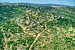
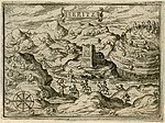
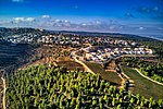
Nitaf (Arabic: نطاف, Natâf) was a small Palestinian Arab village in the Jerusalem Subdistrict. It was depopulated during the 1947–1948 Civil War in Mandatory Palestine on April 15, 1948, during the second stage of Operation Dani. It was located 17 km west of Jerusalem, just north of Bayt Thul. The Israeli village of Nataf was built in 1982, south of the ruins of Nitaf.
Excerpt from the Wikipedia article Nitaf (License: CC BY-SA 3.0, Authors, Images).Nitaf
דרך המעיין, Mate Yehuda Regional Council
Geographical coordinates (GPS) Address Nearby Places Show on map
Geographical coordinates (GPS)
| Latitude | Longitude |
|---|---|
| N 31.836944444444 ° | E 35.065277777778 ° |
Address
דרך המעיין
דרך המעיין
Mate Yehuda Regional Council
Jerusalem District, Israel
Open on Google Maps


