place

Hills Road, Cambridge

Homerton College, CambridgeRoads in CambridgeshireStreets in CambridgeTransport in CambridgeUse British English from November 2017
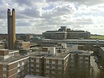
Laboratory of Molecular Biology

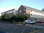
Hills Road is an arterial road (part of the A1307) in southeast Cambridge, England. It runs between Regent Street at the junction with Lensfield Road and Gonville Place (the A603) to the northwest and a roundabout by the Cambridge Biomedical Campus, continuing as Babraham Road (also part of the A1307) to the southeast. On the corner with Lensfield Road is Our Lady and the English Martyrs Church. To the west of the road is the Cambridge University Botanic Garden. At this point, near the Cambridge War Memorial, Station Road leads to Cambridge railway station to the east. Near the southeast end to the west, just north of the junction with Long Road, is The Perse School, an independent school. The Cambridge Biomedical Campus is to the southwest of the roundabout at the southeastern end, at the edge of the city and houses Addenbrooke's Hospital. The original hospital was located on the Old Addenbrooke's Site on Trumpington Street in central Cambridge. Also on Hills Road are: Homerton College, a constituent college of the University of Cambridge The Perse School Cambridge Cancer Genomics, a biotechnology company using artificial intelligence to tailor cancer therapies. Hills Road Sixth Form College St John the Evangelist church

Excerpt from the Wikipedia article Hills Road, Cambridge (License: CC BY-SA 3.0, Authors, Images).

Hills Road, Cambridge
Hills Road (cycleway), Cambridge Petersfield

Geographical coordinates (GPS) Address Nearby Places
placeShow on map

Wikipedia: Hills Road, CambridgeContinue reading on Wikipedia

Geographical coordinates (GPS)

Latitude Longitude
N 52.18282 ° E 0.14001 °
placeShow on map

Address

Hills Road (cycleway)

Hills Road (cycleway)
CB2 8RJ Cambridge, Petersfield
England, United Kingdom
mapOpen on Google Maps

Laboratory of Molecular Biology
Share experience

Nearby Places

Sedley Taylor Road
Sedley Taylor Road

Sedley Taylor Road is a road in west Cambridge, England. It is reputedly one of the most expensive in the UK and the most expensive in East Anglia. The road was built on land owned by Trinity College and named after one of its professors, Sedley Taylor (1834–1920). No 31 was the home of Nobel Prize-winning physicists Sir Nevill Mott and Sir John Cockcroft. No 12 (Tretherbyn) was home to explorer and archaeologist Tom Lethbridge. Alcantara, a house near the South end of the street, is grade II listed.No 22 was built by architect S E Urwin for his own use.The street numbering is consecutive, starting at 1 on the West side at the North end counting to 23 at the South end. 24 to 44 are on the East side of the road, but until 2009 there was no number 30. The postcode on the planning consent for No 30 also illustrates that postcodes in the road were changed in 2007, from CB2 2xx to CB2 8xx, and older documents referring to the street may therefore not use a correct postcode. The East side houses formerly had direct access to the Perse School playing fields but that ended when a rabbit fence was erected in the playing fields in 2011. Speed reduction measures including "gates" (limiting the road to half-width) and humps were installed in 2009. In 2012, residents unsuccessfully opposed plans for a new sports pavilion in the land to the West of the road.Sedley Taylor Road is mentioned in Tom Sharpe's book Grantchester Grind as the home of the widow of local solicitor, Waxthorne.