North Philadelphia

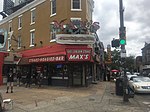
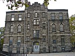
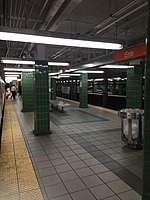
North Philadelphia, nicknamed North Philly, is a section of Philadelphia, Pennsylvania. It is immediately north of Center City. Though the full extent of the region is somewhat vague, "North Philadelphia" is regarded as everything north of either Vine Street or Spring Garden Street, between Northwest Philadelphia and Northeast Philadelphia. It is bordered to the north by Cheltenham Township along Cheltenham Avenue, Spring Garden Street to the south, 35th Street to the west and Adams Avenue to the east. The Philadelphia Police Department patrols five districts located within North Philadelphia: the 22nd, 25th, 26th, 35th and 39th districts. There are fifteen ZIP codes for North Philadelphia: 19120, 19121, 19122, 19123, 19125, 19126, 19130, 19132, 19133, 19134, 19137, 19138, 19140, 19141, and 19150. The city government views this sprawling chunk of Philadelphia more precisely as three smaller districts, drawn up by the Redevelopment Authority in 1964. These regions are (from north to south) Olney-Oak Lane, Upper North Philadelphia and Lower North Philadelphia. Other sections of North Philadelphia include Brewerytown, Fairhill, Fairmount, Fishtown, Francisville, Franklinville, Glenwood, Hartranft, Koreatown, Northern Liberties, Poplar (roughly bound by Girard Avenue, Broad Street, Spring Garden Street and 5th Street), Sharswood, Strawberry Mansion, and Yorktown.
Excerpt from the Wikipedia article North Philadelphia (License: CC BY-SA 3.0, Authors, Images).North Philadelphia
Rising Sun Avenue, Philadelphia
Geographical coordinates (GPS) Address Nearby Places Show on map
Geographical coordinates (GPS)
| Latitude | Longitude |
|---|---|
| N 40.006762 ° | E -75.142863 ° |
Address
Rising Sun Avenue
Rising Sun Avenue
19140 Philadelphia
Pennsylvania, United States
Open on Google Maps


