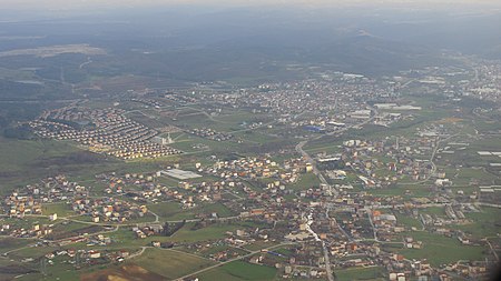
Arnavutköy (district)
Arnavutköy, IstanbulCities in TurkeyIstanbul Province geography stubs

Arnavutköy (meaning "Albanian village" in Turkish) is a town and rural district in Istanbul Province, Turkey. The district was newly formed in 2008 from the large rural part of Gaziosmanpaşa district and parts of other districts, including Çatalca. The mayor is Ahmet Haşim Baltacı of the AKP. It is located on the European side of Istanbul and borders the Black Sea. The name of a neighborhood in the district, Hadımköy, was often spelled "Hademkeui" in European sources. Istanbul Airport is in the district.
Excerpt from the Wikipedia article Arnavutköy (district) (License: CC BY-SA 3.0, Authors, Images).Arnavutköy (district)
Fatih Caddesi,
Geographical coordinates (GPS) Address Nearby Places Show on map
Geographical coordinates (GPS)
| Latitude | Longitude |
|---|---|
| N 41.185555555556 ° | E 28.740555555556 ° |
Address
Redif Sokak
Fatih Caddesi
34275 , Arnavutköy Merkez Mah.
Türkiye
Open on Google Maps


