place

Hatherwood Battery

1869 establishments in EnglandArtillery batteriesForts on the Isle of WightInfrastructure completed in 1869Palmerston Forts
Use British English from June 2015
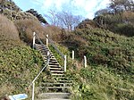
Hatherwood Point and Alum Bay geograph.org.uk 1377275

Hatherwood Battery (map reference SZ308857) is a battery located to the east of Alum Bay on the Isle of Wight. It is one of the many Palmerston Forts built on the island to protect it in response to a perceived French invasion. It was sited to cross fire with the nearby Needles Battery Originally designed to mount six 68 Pounder guns, construction of the battery began in 1865. Before it was completed it was decided to mount seven guns in three groups. This comprised two 9-inch Rifled Muzzle Loading (RML) guns on each flank and three 7-inch Rifled Breech Loading (RBL) guns in the centre. The battery was complete by 1869. There was no accommodation at the battery for the soldiers who would man it. Instead these men were billetted at nearby Golden Hill Fort. In 1903 the battery was officially disarmed. Today not much is left of the battery as it has been left to decay, with some parts falling off the cliff due to erosion.

Excerpt from the Wikipedia article Hatherwood Battery (License: CC BY-SA 3.0, Authors, Images).

Hatherwood Battery
Alum Bay New Road,

Geographical coordinates (GPS) Address Nearby Places
placeShow on map

Wikipedia: Hatherwood BatteryContinue reading on Wikipedia

Geographical coordinates (GPS)

Latitude Longitude
N 50.670603 ° E -1.564813 °
placeShow on map

Address

Alum Bay New Road
PO39 0JD
England, United Kingdom
mapOpen on Google Maps

Hatherwood Point and Alum Bay geograph.org.uk 1377275
Share experience

Nearby Places

Scratchell's Bay
Scratchell's Bay

Scratchell's Bay is a bay on the south west coast of the Isle of Wight, England just to the south east of The Needles. It faces roughly south towards the English Channel, it is 250m in length and is straight. The name is thought to have come from one of the many names for the Devil. The bay itself is shallow, and the 2m contour is approximately 200m from the cliff face. The beach is made up mostly of shingle and can only, reasonably, be reached by boat. There is no path from the top of the cliff. A small cave is located just into the sea at the east end of the bay near Sun Corner. Approximately 150m west of the Easterly promontory is the large St.Anthony's Rock; It is a-wash at low tide (dries to 0.6m on spring low) and is a significant hazard to boats. The bay is best viewed from either the lookout point near the rocket launching facility or the Needles Old Battery National Trust property on the cliff top. During a storm of 24 January 1890, the iron-clad Irex on her way to Rio de Janeiro with a load of iron pipes, had turned back from Biscay to seek shelter. Due to a navigation error, she was wrecked and sank in the bay with the loss of six lives, The wreck still lies within the bay and a large portion of the floor of the bay is scattered with the remains of the ship and its cargo presenting multiple fouling hazards. The hull of the ship is largely intact and lies roughly 15 degrees from parallel to the beach, rising rapidly from 5m or so and awash on spring lows, thus she presents a significant danger to keeled craft and larger leisure boats. For vessels entering the bay, it is vital to locate both the wreck and St.Anthony's rock.