Holderness Wapentake
East Riding of Yorkshire geography stubsHoldernessWapentakes of the East Riding of Yorkshire

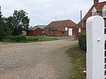
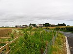
Holderness was a wapentake of the historic East Riding of Yorkshire, England consisting of the south-easterly part of the county. Established in medieval times, it ceased to have much significance in the 19th century when the wapentakes were superseded by other administrative divisions for most local government purposes. Because of its large area it was sub-divided into three divisions—North Division, Middle Division and South Division.
Excerpt from the Wikipedia article Holderness Wapentake (License: CC BY-SA 3.0, Authors, Images).Holderness Wapentake
Beverley Road,
Geographical coordinates (GPS) Address Nearby Places Show on map
Geographical coordinates (GPS)
| Latitude | Longitude |
|---|---|
| N 53.848 ° | E -0.201 ° |
Address
Beverley Road
Beverley Road
HU11 4TT , Withernwick
England, United Kingdom
Open on Google Maps


