place

Julia Tuttle Causeway sex offender colony

2006 establishments in Florida2010 disestablishments in FloridaGovernment of MiamiHomelessness in the United StatesHuman rights abuses
Miami-Dade County, FloridaPenal system in FloridaSex and the lawSex offender registries in the United StatesSexuality in Florida
Greater coat of arms of the United States

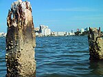
The Julia Tuttle Causeway sex offender colony (also called "Bookville" by former residents) was an encampment of banished, registered sex offenders who were living beneath the Julia Tuttle Causeway—a highway connecting Miami, Florida to Miami Beach, Florida, United States—from 2006 to April 2010. The colony was created by a lobbyist named Ron Book, who wrote ordinances in several different Miami-Dade County cities to restrict convicted sex offenders from living within 2,500 feet (760 m) of schools, parks, bus stops, or homeless shelters. Since Book was also head of the Miami Homeless Trust, he was also in charge of finding housing for the released sexual offenders. Under these ordinances, the only areas where sex offenders could legally reside within Miami-Dade County were the Miami Airport and the Florida Everglades. Miami-Dade laws are significantly stricter than State of Florida laws on residency restrictions for sex offenders. Florida state law required that no sex offender could live within 1,000 feet (300 m) from "where children gather". Under that requirement, housing was possible; however, because of Book's lobbying, the Dade County Commission increased that number to 2,500 feet (760 m), thereby banishing hundreds of local citizens who then began gathering under the Julia Tuttle Causeway.

Excerpt from the Wikipedia article Julia Tuttle Causeway sex offender colony (License: CC BY-SA 3.0, Authors, Images).

Julia Tuttle Causeway sex offender colony
Julia Tuttle Causeway, Miami

Geographical coordinates (GPS) Address Nearby Places
placeShow on map

Wikipedia: Julia Tuttle Causeway sex offender colonyContinue reading on Wikipedia

Geographical coordinates (GPS)

Latitude Longitude
N 25.8105 ° E -80.1735 °
placeShow on map

Address

Julia Tuttle Bridge (Tuttle Bridge)

Julia Tuttle Causeway
33137 Miami
Florida, United States
mapOpen on Google Maps

Greater coat of arms of the United States
Share experience

Nearby Places

Paraíso Bay

Paraíso Bay is a group of four adjacent high-rise buildings in the Edgewater neighborhood of Miami, Florida, United States. Two of the towers, Paraiso Bay and Grand Paraiso, are nearly identical, rising about 550 feet (168 m) with 54 floors, and adjoined by a common amenities, parking and recreation structure. The two additional towers are branded ONE Paraíso (53 floors, height of 601 feet) and Paraíso Bayviews (46 floors, height of 500 feet) and are standalone buildings. Collectively, the buildings contain over 1300 residential units. A separate two-story structure is located on the water and currently houses a restaurant operated by James Beard Award-winning chef, Michael Schwartz. The restaurant, called Amara at Paraiso, is open to the public. The development also incorporates a bay-front park, called Paraiso Park, that includes a children's playground and fenced-in dog park. Collectively, the residential buildings, restaurant structure and park are referred to as The Paraiso District. The development is located directly on the Biscayne Bay and all residential units enjoy direct views of the water. Construction of the project started in July 2014 and was completed in 2018. Several city officials joined in the groundbreaking ceremony, including mayor Tomás Regalado. The developer, The Related Group, pledged to include a public park as part of the project due to a land swap deal that allowed them to close the end of a city street. The project was formerly approved as Element by a separate developer.Paraíso is Spanish for paradise.