Chichester to Silchester Way
Archaeological sites in HampshireArchaeological sites in West SussexRoman roads in EnglandUse British English from April 2017

The Chichester to Silchester Way is a Roman Road between Chichester in South-East England, which as Noviomagus was capital of the Regni, and Silchester or Calleva Atrebatum, capital of the Atrebates. The road had been entirely lost and forgotten, leaving no Saxon place names as clues to its existence, until its chance discovery through aerial photography in 1949. Only 6 kilometres (3.7 mi) of the 62 kilometres (39 mi) long road remain in use.
Excerpt from the Wikipedia article Chichester to Silchester Way (License: CC BY-SA 3.0, Authors, Images).Chichester to Silchester Way
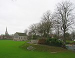
City Walls, Chichester Chichester
Geographical coordinates (GPS) Address Nearby Places Show on map
Geographical coordinates (GPS)
| Latitude | Longitude |
|---|---|
| N 50.84 ° | E -0.779 ° |
Address
City Walls
City Walls
PO19 1BY Chichester, Chichester
England, United Kingdom
Open on Google Maps


