place

Leslie Park

Neighbourhoods in OttawaUse Canadian English from January 2023

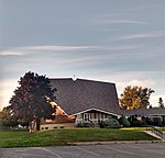
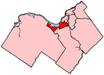
Leslie Park is a suburban neighbourhood in College Ward in the city of Ottawa, Ontario, Canada. It is located in the former city of Nepean. Leslie Park is bounded on the north by Baseline Road, on the east by Greenbank Road and on the south by the OCRR. The Leslie Park Community Association has the fence west of Costello St as the western boundary. According to the Canada 2016 Census, the population of the neighbourhood (including the Valley Steam area) was 3,228.The neighbourhood was built from 1963-1970s and mid 1980s. Monterey Drive has many stone brick English-style townhouses. By the 1970s more townhouses were built on Costello Avenue and a 17-unit condominium was built at 50 Greenbank. In the 1980s homes on Sandcastle Drive and Valley Stream Drive were built with two high rise condominiums. In the early 2000s more townhouses were built west of Guthrie between Monterey and Baseline Road. Leslie Park is among the neighbourhoods having the oldest trees over a century old. Leslie Park contains two parks (Leslie Park, and Brucelands Park). It also contains two schools (Leslie Park Public School and St. John the Apostle Catholic School).

Excerpt from the Wikipedia article Leslie Park (License: CC BY-SA 3.0, Authors).

Leslie Park
Harrison Street, Ottawa Nepean

Geographical coordinates (GPS) Address Nearby Places
placeShow on map

Wikipedia: Leslie ParkContinue reading on Wikipedia

Geographical coordinates (GPS)

Latitude Longitude
N 45.336111111111 ° E -75.79 °
placeShow on map

Address

École élémentaire publique Ottawa Ouest

Harrison Street 20
K2H 7N5 Ottawa, Nepean
Ontario, Canada
mapOpen on Google Maps

Share experience

Nearby Places

Sir Robert Borden High School

Sir Robert Borden High School (SRB, Borden) is a high school located on Greenbank Road in the Nepean district of Ottawa, Ontario, Canada. Adjacent to the main office of the Ottawa-Carleton District School Board, this school was built in 1969 and officially opened on December 5, 1969. It is named after the late Conservative Prime Minister of Canada, Robert Borden. Architecturally, the building itself is divided into several different wings. The wing known affectionately as "The Square" (Named after its imposing shape overlooking Greenbank Road) houses the science, computer, English, and combined French and social sciences departments. Another wing, "The Circle", which overlooks sports fields and a local neighbourhood, houses the Technology and Drama departments, the keyboarding room and all Grade 7 to 8 classes starting in 2017-2018 School year. These two wings are centred on a foyer on the main level, which is a popular place for students to socialize. The additional courses are provided in portables northeast of most of the school near where the Middle-schoolers have recess. The portables contains the remainder of the departments that could not fit into the interior of the school due to the allocated space to the Grade 7/8s. The portables also contains the Athletics department, as the Health units of Gym/Fitness and certain courses is taught there. The Foyer is the centre of the school, being at the entrance in cross-roads between the square, gymnasium, auditorium, locker bay and library. The foyer is currently used to host activities like the "Foyer Games" which is a party game-like activity with games like Horses and Cavaliers occurring during Fridays, Thursdays when Friday isn't available and Spirit Weeks. A sound system was installed to facilitate performances by student bands or student council activities over the lunch hour during 1999. However, and as of 2019 it is currently not being used and unplugged in lieu of bringing speakers in. There is also a multi-purpose auditorium, which has partitions which can divide the hall into three smaller lecture theatres, and 2 large gymnasiums with their own partitions, which makes them ideal for hosting high school athletics. Sir Robert Borden High School is often recognized in its community for its leading music, arts and athletics programs, having won many local sports championships and arts and music competitions. The school mascot, Bolt the Bengal, represents its many sports teams and clubs. The school is also used after hours and on weekends by many community groups and sports leagues, and is often used as a polling station in municipal, provincial and federal elections. Starting with the 2017-2018 year, the school includes grades 7-12, absorbing Greenbank Middle School. The school's principal is Matt Gagnier.

Qualicum-Graham Park

Qualicum-Graham Park or Qualicum is a suburban neighbourhood in College Ward in the City of Ottawa, Ontario, Canada. It is located in the former City of Nepean in the west end of the city. Many of the residences in the area are executive homes situated on large lots (100x100) being built in the 1960s. Qualicum Street boasts large custom houses built by Bill Teron. The neighbourhood is bounded to the north by the Queensway, to the west by Richmond Road, to the south by Baseline Road, and to the east by Morrison Drive at the former Ottawa-Nepean border towards Redwood. Named after Qualicum Beach in British Columbia. According to the Canada 2011 Census, the total population of the neighbourhood was 1,715.Most of the streets are named after Aboriginal peoples and towns in British Columbia. The following streets are located in the community: Aleutian Road- named after the Aleutian Islands in Alaska. Chinook Crescent- the Chinook winds in the Canadian Prairies. Cowichan Way- named after the Cowichan peoples in BC. Esquimalt Avenue- a town on Vancouver Island. One of the main streets in the neighborhood; starts at Beaumaris and ends at Okanagan Kitimat Crescent-Town in northwestern British Columbia Kitsilano Court- Named after a suburb in Vancouver, British Columbia. Located at the former Graham Park Public School grounds in Qualicum-Graham Park. Built in 2015. Mohawk Crescent- Named after the Mohawk people. The tribe is located in the St. Lawrence Region; Southern Quebec, Eastern Ontario, and Northern New York. Nanaimo Drive-A town in Vancouver Island. Another main street in the neighbourhood. Okanagan Drive- Named after the Okanagan Valley around the Rocky Mountains in BC. Starts at Nanaimo Drive, which curves and ends at Baseline Road. Qualicum Street- Named after Qualicum Beach on Vancouver Island. Qualicum street is parallel along Baseline Road. Starts at Draper Avenue and ends at Esquimalt Avenue. Sioux Crescent- Named after the Sioux in the Northern United States(Minnesota, Dakotas, Iowa and Montana) and the Prairies in Central Canada (Alberta, Manitoba and Saskatchewan).