Central Avenue (Hudson Palisades)
Infobox road instances in New JerseyInfobox road maps tracking categoryNeighborhoods in Jersey City, New JerseyStreets in Hudson County, New JerseyTransportation in Hudson County, New Jersey

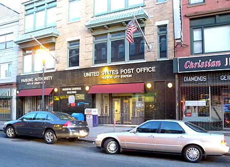
Central Avenue is a 12-block-long thoroughfare in the Heights neighborhood of Jersey City, New Jersey, United States. One of 13 shopping districts in the city, it is designated County Route 663 for 1.60-mile (2.57 km) of its length. It originates at the intersection of Summit Avenue and Pavonia Avenue, and runs north, intersecting Newark Avenue one block east of Five Corners to Paterson Plank Road near Transfer Station. The avenue continues north through Union City without the county route designation to 35th Street (CR 674), two blocks north of Hackensack Plank Road.
Excerpt from the Wikipedia article Central Avenue (Hudson Palisades) (License: CC BY-SA 3.0, Authors, Images).Central Avenue (Hudson Palisades)
Jefferson Avenue, Jersey City
Geographical coordinates (GPS) Address Nearby Places Show on map
Geographical coordinates (GPS)
| Latitude | Longitude |
|---|---|
| N 40.738 ° | E -74.054 ° |
Address
Jefferson Avenue 109
07306 Jersey City
New Jersey, United States
Open on Google Maps


