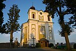
Suchý Důl
Hradec Králové Region geography stubsPopulated places in Náchod DistrictVillages in Náchod District

Suchý Důl (German: Dörrengrund) is a municipality and village in Náchod District in the Hradec Králové Region of the Czech Republic. It has about 400 inhabitants.
Excerpt from the Wikipedia article Suchý Důl (License: CC BY-SA 3.0, Authors, Images).Suchý Důl
okres Náchod
Geographical coordinates (GPS) Address Nearby Places Show on map
Geographical coordinates (GPS)
| Latitude | Longitude |
|---|---|
| N 50.54 ° | E 16.265555555556 ° |
Address
24
549 62 okres Náchod
Northeast, Czechia
Open on Google Maps


