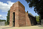
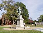
The Jamestown settlement in the Colony of Virginia was the first permanent English settlement in the Americas. It was located on the northeast bank of the James River, about 2.5 mi (4 km) southwest of the center of modern Williamsburg. It was established by the Virginia Company of London as "James Fort" on May 4, 1607 O.S. (May 14, 1607 N.S.), and was considered permanent after a brief abandonment in 1610. It followed several failed attempts, including the Lost Colony of Roanoke, established in 1585 on Roanoke Island, later part of North Carolina. Jamestown served as the colonial capital from 1616 until 1699. Despite the dispatch of more settlers and supplies, more than 80 percent of the colonists died in 1609–1610, mostly from starvation and disease. In mid-1610, the survivors abandoned Jamestown, though they returned after meeting a resupply convoy in the James River.
In August 1619, the first recorded slaves from Africa to British North America arrived in what is now Old Point Comfort near the Jamestown colony, on a British privateer ship flying a Dutch flag. The approximately 20 Africans from present-day Angola had been removed by the British crew from the Portuguese slave ship São João Bautista. They most likely worked in the tobacco fields as slaves under a system of race-based indentured servitude. One of their number included Angela, who was purchased by William Peirce. The modern conception of slavery in the British colonies was formalized in 1640 (the John Punch hearing) and was fully entrenched in the Colony of Virginia by 1660.The London Company's second settlement in Bermuda claims to be the site of the oldest town in the English New World, as St. George's, Bermuda, was officially established in 1612 as New London, whereas James Fort in Virginia was not converted into James Towne until 1619, and further did not survive to the present day.In 1676, Jamestown was deliberately burned during Bacon's Rebellion, though it was quickly rebuilt. In 1699, the colonial capital was moved to what is today Williamsburg, Virginia; Jamestown ceased to exist as a settlement, and remains today only as an archaeological site, Jamestown Rediscovery.
It is known for its historical significance as the site of the first permanent English settlement in America. The town is home to several museums and historical sites, including the Jamestown Settlement and the American Revolution Museum at Yorktown, which showcase the rich history of the area.
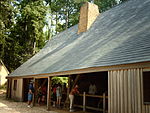
Today, Jamestown is one of three locations composing the Historic Triangle of Colonial Virginia, along with Williamsburg and Yorktown, with two primary heritage sites. Historic Jamestowne is the archaeological site on Jamestown Island and is a cooperative effort by Jamestown National Historic Site (part of Colonial National Historical Park) and Preservation Virginia. Jamestown Settlement, a living history interpretive site, is operated by the Jamestown Yorktown Foundation, a state agency of the Commonwealth of Virginia.


