place

Little River (Presumpscot River tributary)

Buxton, MaineGorham, MaineMaine river stubsRivers of Cumberland County, MaineRivers of Maine
Rivers of York County, MaineWindham, Maine

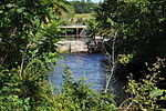
The Little River is an 18.8-mile-long (30.3 km) tributary of the Presumpscot River in the U.S. state of Maine. It rises in the northern part of the town of Buxton in York County and flows southeast, then northeast into Gorham in Cumberland County. It flows northeast and east across Gorham, reaching the Presumpscot at the eastern boundary of the town, across from Windham.

Excerpt from the Wikipedia article Little River (Presumpscot River tributary) (License: CC BY-SA 3.0, Authors).

Little River (Presumpscot River tributary)
Mosher Road,

Geographical coordinates (GPS) Address Website Nearby Places
placeShow on map

Wikipedia: Little River (Presumpscot River tributary)Continue reading on Wikipedia

Geographical coordinates (GPS)

Latitude Longitude
N 43.71647 ° E -70.41088 °
placeShow on map

Address

Saint Pierre Preserve

Mosher Road
04038
Maine, United States
mapOpen on Google Maps

Website
prlt.org

linkVisit website

Share experience

Nearby Places

Cumberland and Oxford Canal

The Cumberland and Oxford Canal was opened in 1832 to connect the largest lakes of southern Maine with the seaport of Portland, Maine. The canal followed the Presumpscot River from Sebago Lake through the towns of Standish, Windham, Gorham, and Westbrook. The Canal diverged from the river at Westbrook to reach the navigable Fore River estuary and Portland Harbor. The canal required 27 locks to reach Sebago Lake at an elevation of 267 feet (81 m) above sea level. One additional lock was constructed in the Songo River to provide 5 feet (1.5 m) of additional elevation to reach Long Lake from Sebago Lake. Total navigable distance was approximately 38 miles (61 km) from Portland to Harrison at the north end of Long Lake. A proposed extension from Harrison to Bear Pond and Tom Pond in Waterford would have required three more locks on the Bear River, but they were never built.A state lottery was authorized to help raise $50,000 for the project, and the Canal Bank of Portland was chartered in 1825. The canal was completed in 1830 at a cost of $206,000. The excavated portions of the canal had a surface width of 30 feet (9.1 m) with a 10 feet (3.0 m) wide channel 3.5 feet (1.1 m) deep. The locks were 10 feet (3.0 m) wide and 80 feet (24 m) long. Lock walls were made of granite masonry with wooden gates at either end. A lock keeper was stationed at each lock to move the lock gates with heavy timber balance beams, manipulate iron valves to adjust water levels within the lock, and collect a 6 cent fee for use of the lock.