place

Raymore Drive

1954 disasters in Canada1954 in Canada1954 in OntarioFloods in CanadaHistory of Toronto
Hurricane HazelStreets in Toronto
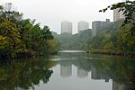
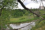
Raymore Drive in Raymore Park

Raymore Drive is a mostly residential street in the Weston neighbourhood of Toronto in the Canadian province of Ontario. It runs next to the Humber River. On October 15, 1954, the area was severely affected by Hurricane Hazel. When the Humber River burst its banks and tore away a footbridge, the waters of the Humber were redirected through the neighbourhood. The flood killed 35 residents and washed away 39 percent of the street. The washed-away part of Raymore Drive was never rebuilt, as subsequent residential development in that area has been prohibited; it is now part of Raymore Park. All together, Hazel was responsible for 81 deaths in Canada.

Excerpt from the Wikipedia article Raymore Drive (License: CC BY-SA 3.0, Authors, Images).

Raymore Drive
Raymore Drive, Toronto Etobicoke

Geographical coordinates (GPS) Address Nearby Places
placeShow on map

Wikipedia: Raymore DriveContinue reading on Wikipedia

Geographical coordinates (GPS)

Latitude Longitude
N 43.69665 ° E -79.515066666667 °
placeShow on map

Address

Raymore Drive 95
M9N 1W2 Toronto, Etobicoke
Ontario, Canada
mapOpen on Google Maps

Raymore Drive in Raymore Park
Share experience

Nearby Places

Central United Church

Central United Church is a historic congregation of the United Church of Canada located in the community of Weston, now a neighbourhood of Toronto, Ontario, Canada. Founded in 1821 (1821), the church has occupied the same site on Weston Road in Toronto since then.The congregation began as part of the Methodist Episcopal Church, a forerunner of both the Methodist Church of Canada (1884) and the United Church of Canada (1925). The first church building, a log structure, was erected in 1821, followed by a larger brick church constructed in 1849. The present building, dedicated in 1887, and built in the Gothic Revival style, has been altered and updated on several occasions, but retains the landmark tower. The tower includes examples of abat-sons. The church was one of the final projects of William Henry Mallory Sr., architect.The congregation has a unique musical heritage. The organ, constructed by Casavant Frères, was dedicated in 1950 as a memorial to members of the congregation who gave their lives in the Second World War. The Chancellors, a youth choir active from 1968 to 1980, produced five record albums and toured extensively. The congregation has been served by several notable clergy, including Egerton Ryerson, historian George Playter and E.A. Pearson, the father of Prime Minister Lester B. Pearson. Today, the church is well known for outreach into the community through the Weston King Neighbourhood Centre. The Centre provides meals, education and advocacy.

De Lesseps Field

De Lesseps Field was a small, but important airfield in early aviation in Toronto, Ontario, Canada. Opened sometime before 1910, an airfield was created from three farms by engineer William G. Trethewey (1865–1926). The airfield was located near present-day Hearst Circle and the Wishbone on a 600 acres (2.4 km2) site in York Township (just outside Weston, Ontario).The grassy airfield was later used by French aviator Count Jacques Benjamin de Lesseps (1883–1927) and later renamed after him. The property remained in the hands of the Trethewey family after the death of Trethewey, but in 1928 Trethewey's son Fred sold it to airline Skyways Limited. de Havilland Canada established their first home here in 1928 (building a small hangar) to build Gipsy Moth and Tiger Moth aircraft, but left for Downsview in 1929. Skyways remained owners until some time after 1931 and the airline moved to the Malton Airport. The farm and airfield was later re-developed as residential housing. No trace of the airfield remains in the area. Besides aircraft manufacturing, the airfield hosted air shows starting in 1910 (hosted by the Ontario Motor League).This airfield was one of many airfields in the greater Toronto area during the early 20th Century, but most of the airfields disappeared before World War II: Armour Heights Field 1917-1919 Barker Field 1927-1953 Downsview Airfield 1929–present Leaside Aerodrome 1927-1931 Long Branch Aerodrome 1915-1919 Toronto Aerodrome 1928-1939Most of the airfield related buildings were temporary or converted from farm use. De Havilland's first factory was in an old vegetable warehouse because it had double doors wide enough to accommodate assembled aircraft. A larger hangar was built in 1929, but it was moved along with the aircraft manufacturer to Downsview.The later owners of the airfield, Skyways Limited, used the facilities to train pilots.