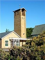
place

Rossall School

1844 establishments in EnglandAstronomical observatories in EnglandAstronomy educationBoarding schools in LancashireChurch of England private schools in the Diocese of Blackburn
E. G. Paley buildingsEducational institutions established in 1844Grade II listed buildings in LancashireGrade II listed educational buildingsInternational Baccalaureate schools in EnglandMember schools of the Headmasters' and Headmistresses' ConferencePrivate schools in LancashireRossall SchoolSchools in the Borough of WyreSchools with a royal charterUse British English from August 2013
Rossall Logo
Rossall Logo

Rossall School is a public school (English fee-charging boarding and day school) for 0–18 year olds, between Cleveleys and Fleetwood, Lancashire. Rossall was founded in 1844 by St Vincent Beechey as a sister school to Marlborough College which had been founded the previous year. Its establishment was "to provide, at a moderate cost, for the sons of Clergymen and others, a classical, mathematical and general education of the highest class, and to do all things necessary, incidental, or conducive to the attainment of the above objects." Along with Cheltenham, Lancing and Marlborough, Rossall was part of a flurry of expansion in public school education during the early Victorian period. Set in a 161-acre (0.65 km2) estate next to Rossall Beach, and now with about 900 students, Rossall is a member of the Headmasters' and Headmistresses' Conference and was granted a royal charter on 21 October 1890. It is an 'all-through' school with a nursery, 'pre-prep', preparatory and senior school. Rossall's campus has a large array of facilities for extracurricular activities and the school is home to the Lawrence House Space Science and Astronomy Centre, the only facility of its type in the UK. Over the years, Rossall has adapted itself to changing attitudes in education, and was the first school in the UK to have a Combined Cadet Force and one of the first to introduce the International Baccalaureate and host a dedicated international study centre on campus.

Excerpt from the Wikipedia article Rossall School (License: CC BY-SA 3.0, Authors, Images).

Rossall School
Broadway, Borough of Wyre Rossall

Geographical coordinates (GPS) Address Phone number Website External links Nearby Places
placeShow on map

Wikipedia: Rossall SchoolContinue reading on Wikipedia

Geographical coordinates (GPS)

Latitude Longitude
N 53.8957 ° E -3.0424 °
placeShow on map

Address

Rossall School

Broadway
FY7 8JW Borough of Wyre, Rossall
England, United Kingdom
mapOpen on Google Maps

Phone number

call+441253774201

Website
rossall.org.uk

linkVisit website

linkWikiData (Q5493652)
linkOpenStreetMap (244467264)

Rossall Logo
Rossall Logo
Share experience

Nearby Places

Rossall Point Observation Tower

Rossall Point Observation Tower is an observation tower in Fleetwood, Lancashire, England. The four-storey 46-foot-high (14 m) tower was completed in March 2013. It is also used as a beacon and was designed by Studio Three Architects.Located on the sand dunes between Cleveleys and Fleetwood, the tower's second floor is a base for the National Coastwatch Institution and its top level provides an open observation deck on its top level for the general public and bird watchers. With views over the Lakeland fells out across Morecambe Bay and the Irish Sea, it is part of Wyre Council's project Sea Change, a £2.1 million redevelopment product. It provides a 360° panorama.The four-storey tower replaces the old observation tower which was no longer fit for purpose. The older tower was a coastguard tower built in 1948 which also provided a public viewing platform. In December 2011, the Orange mast next to the tower was removed. The roof of the old tower (viewing platform) was moved in early 2012 and the remains of the tower were converted into a toilet. Work on the new tower officially began in February 2012.The ground floor gallery is used as an education facility by Wyre Council's Coast and Countryside Rangers. A camera at the top of the tower shows pictures which are then shown on a screen in the education facility for those unable to climb to the top floor.Councillor Gordon McCann, cabinet member with responsibility for economic development at Wyre Council, called the tower "distinctive" with "stunning" "views".It is one of two observation towers with views over the Lancashire coastline, alongside Blackpool Tower; formerly, Morecambe was home to Morecambe Tower and the Polo Tower.

A587 road
A587 road

The A587 is a road in England that runs from Blackpool to Fleetwood in Lancashire. The road runs a total distance of approximately 9.5 miles (15.3 km), largely on residential and commercial streets. It begins close to the Oxford junction in Marton, in the south-eastern part of Blackpool (53.8043°N 3.0246°W / 53.8043; -3.0246 (A587 road (southern end))), as a turning off the A583, Preston New Road. It continues north, as South Park Drive and later East Park Drive, past Stanley Park and Blackpool Victoria Hospital for about 1.5 miles (2.4 km), until the Four Lane Ends roundabout. At this point, as St Walburga's Road, it continues north, and later becomes dual carriageway for 0.7 miles (1.1 km) which forms a border between the suburbs of Layton and Grange Park. After the Plymouth Road roundabout, it crosses the railway close to Layton station, and continues north as Bispham Road for a further 1.4 miles (2.3 km), passing through the Warbreck area before reaching Bispham roundabout. From Bispham it then continues north, as Devonshire Road and later Fleetwood Road, for a further 1.3 miles (2.1 km) through the north Blackpool suburbs of Norbreck and Little Bispham before it is joined at Anchorsholme by the A584 Queen's Promenade. The A587 then heads north for 0.5 miles (0.80 km) as a dual carriageway, named Fleetwood Road and Kelso Avenue for north and southbound traffic respectively, with the tram tracks dividing the road until entering the town of Cleveleys, and the Wyre District. Past Cleveleys, as a single lane road, now known as Rossall Road, it continues north for a further 1.5 miles (2.4 km), past Rossall School in a short 40mph section, and into Fleetwood, where it becomes Broadway. The road crosses West View roundabout, and turns right down Poulton Road, eventually terminating at the new Ash Street roundabout, near Fleetwood Freeport (53.9193°N 3.0142°W / 53.9193; -3.0142 (A587 road (northern end))), where it joins to the A585.