Les Chaprais
Areas of Besançon

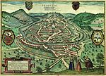
The Chaprais or Chaprais is a district of Besançon, which was developed from the second half of the 19th century. Located in north-east of the historic center, it has 15,500 inhabitants which makes the second bigger area of the city
Excerpt from the Wikipedia article Les Chaprais (License: CC BY-SA 3.0, Authors, Images).Les Chaprais
Rue de la Liberté, Besançon Les Chaprais
Geographical coordinates (GPS) Address Nearby Places Show on map
Geographical coordinates (GPS)
| Latitude | Longitude |
|---|---|
| N 47.2475 ° | E 6.0286111111111 ° |
Address
Rue de la Liberté 17
25000 Besançon, Les Chaprais
Bourgogne-Franche-Comté, France
Open on Google Maps


