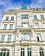
Smolna Street, Warsaw
Poland road stubsStreets in WarsawWarsaw geography stubs

Smolna (Polish: Ulica Smolna) is one of the streets of Warsaw's city centre. It is entirely contained in the Śródmieście district, and runs for approximately 400m, orthogonal to the Vistula river. It is a one-way street, running eastwards from Charles de Gaulle roundabout to Jerusalem Avenue, approximately 1 km west of the river.
Excerpt from the Wikipedia article Smolna Street, Warsaw (License: CC BY-SA 3.0, Authors, Images).Smolna Street, Warsaw
Aleje Jerozolimskie, Warsaw Śródmieście (Warsaw)
Geographical coordinates (GPS) Address Nearby Places Show on map
Geographical coordinates (GPS)
| Latitude | Longitude |
|---|---|
| N 52.232777777778 ° | E 21.023055555556 ° |
Address
Aleje Jerozolimskie 6
00-374 Warsaw, Śródmieście (Warsaw)
Masovian Voivodeship, Poland
Open on Google Maps


