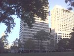
Hyde Park, Sydney

Hyde Park is a heritage-listed 16.2-hectare (40-acre) urban park located in the central business district of Sydney, in the City of Sydney local government area of New South Wales, Australia. It is the oldest public parkland in Australia. Hyde Park is on the eastern fringe of the Sydney city centre and is approximately rectangular in shape, being squared at the southern end and rounded at the northern end. It is bordered on the west by Elizabeth Street, on the east by College Street, on the north by St. James Road and Prince Albert Road and on the south by Liverpool Street.The park was designed by Norman Weekes, Sir John Sulman (1927 design resolution), Alfred Hook, W. G. Layton and I. Berzins and was built from 1810 to 1927. It is also known as Hyde Park, Sydney Common, Government Domain, The Common, The Exercising Ground, Cricket Ground and Racecourse. Hyde Park is owned by the City of Sydney and the Land and Property Management Authority, an agency of the Government of New South Wales. It was added to the New South Wales State Heritage Register on 13 December 2011.It is the southernmost of a chain of parkland that extends north to the shore of Sydney Harbour via The Domain and Sydney's Royal Botanic Gardens. Around the park's boundaries lie various buildings housing the Supreme Court of New South Wales, St. James Church, Hyde Park Barracks and Sydney Hospital to the north, St Mary's Cathedral, the Australian Museum and Sydney Grammar School to the east, the Downing Centre to the south, the David Jones Limited flagship store and the CBD to the west. It is divided in two by the east–west running Park Street. Hyde Park contains well-kept gardens and approximately 580 trees; a mixture of figs, conifers, palms, and other varieties. It is famed for its magnificent fig tree lined avenues. Sandringham Gardens sit on the eastern side of the park, close to the intersection of Park Street and College Street.
Excerpt from the Wikipedia article Hyde Park, Sydney (License: CC BY-SA 3.0, Authors, Images).Hyde Park, Sydney
Park Street, Sydney Sydney
Geographical coordinates (GPS) Address Nearby Places Show on map
Geographical coordinates (GPS)
| Latitude | Longitude |
|---|---|
| N -33.873333 ° | E 151.211389 ° |
Address
Park Street
2000 Sydney, Sydney
New South Wales, Australia
Open on Google Maps


