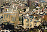
Dwight Street Historic District

The Dwight Street Historic District is an irregularly shaped 135-acre (55 ha) historic district in New Haven, Connecticut. The district is located immediately west of the center of Downtown New Haven and is generally bounded by Elm Street on the north, Park Street on the east, North Frontage Road on the south, and Sherman Avenue on the west. It contains one of the city's highest concentrations of well-preserved 19th and early 20th-century residential architecture, much of which was developed for the working classes in the city's factories. It was listed on the National Register of Historic Places in 1983. The historic district includes most of the Dwight neighborhood and several blocks of the northeast corner of the West River neighborhood.
Excerpt from the Wikipedia article Dwight Street Historic District (License: CC BY-SA 3.0, Authors, Images).Dwight Street Historic District
Sperry Street, New Haven
Geographical coordinates (GPS) Address External links Nearby Places Show on map
Geographical coordinates (GPS)
| Latitude | Longitude |
|---|---|
| N 41.310555555556 ° | E -72.939722222222 ° |
Address
Dwight Street Historic District
Sperry Street
06511 New Haven
Connecticut, United States
Open on Google Maps


