place

Croftfoot

Areas of GlasgowUse British English from May 2015
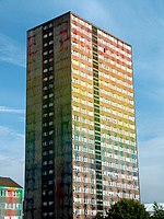
Midcroft Avenue, Croftfoot, Glasgow 2022 (3)

Croftfoot (Scots: Croaftfuit, Scottish Gaelic: Bun a' Chroit) is a residential area on the southeastern side of the Scottish city of Glasgow. It is bordered by Castlemilk to the south and King's Park (both the public park and the residential neighbourhood) to the west within Glasgow, and by the Rutherglen areas of Spittal to the east and Bankhead to the north (across the Cathcart Circle Lines railway). Historically within the civil parish of Cathcart in Renfrewshire, it is within the Linn ward of Glasgow City Council.

Excerpt from the Wikipedia article Croftfoot (License: CC BY-SA 3.0, Authors, Images).

Croftfoot
Croftpark Avenue, Glasgow Croftfoot

Geographical coordinates (GPS) Address Nearby Places
placeShow on map

Wikipedia: CroftfootContinue reading on Wikipedia

Geographical coordinates (GPS)

Latitude Longitude
N 55.8138 ° E -4.2341 °
placeShow on map

Address

Croftpark Avenue

Croftpark Avenue
G44 5NU Glasgow, Croftfoot
Scotland, United Kingdom
mapOpen on Google Maps

Midcroft Avenue, Croftfoot, Glasgow 2022 (3)
Share experience

Nearby Places

Castlemilk
Castlemilk

Castlemilk (Scottish Gaelic: Caisteal Mheilc) is a district of Glasgow, Scotland. It lies to the far south of the city centre, adjacent to the Croftfoot and Simshill residential areas within the city to the north-west, the town of Rutherglen - neighbourhoods of Spittal to the north-east and Fernhill to the east, Linn Park and its golf course to the west, and the separate village of Carmunnock further south across countryside. The area was developed by the Glasgow Corporation as a peripheral housing scheme in the 1950s to accommodate 34,000 people from inner-city slum areas such as the Gorbals. The new residents were provided with open spaces, a clean environment and indoor toilets and bathrooms. The modern development grew around Castlemilk House, a stately old mansion built around Cassilton Tower, which was started in 1460 on the site of a 13th-century castle, and was demolished in 1972.The population had dropped from 37,000 in 1971 to roughly half that number in 1991. However, despite the social problems associated with poverty and unemployment, the area has seen the benefits of a regeneration strategy implemented in the 1980s which has focused on improved housing and the development of local arts. Community groups and Cooperative housing associations have done a lot to regenerate the housing and improve the amenities for local people. A swimming pool, sports centre, shopping arcade and community centres have been developed.