Toryglen
Areas of GlasgowHousing estates in GlasgowUse British English from September 2017

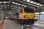
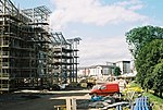
Toryglen is a district in southern Glasgow, Scotland, falling within the Langside ward under Glasgow City Council. It is approximately two miles south of the city centre, bounded to the west by Mount Florida, the north-west by Polmadie, to the north-east by the West Coast Main Line railway and the M74 motorway the south by King's Park, and immediately to the east by the town of Rutherglen.
Excerpt from the Wikipedia article Toryglen (License: CC BY-SA 3.0, Authors, Images).Toryglen
Glenmore Place, Glasgow Toryglen
Geographical coordinates (GPS) Address Nearby Places Show on map
Geographical coordinates (GPS)
| Latitude | Longitude |
|---|---|
| N 55.82812 ° | E -4.234629 ° |
Address
St Brigid's Primary School
Glenmore Place
G42 0EH Glasgow, Toryglen
Scotland, United Kingdom
Open on Google Maps


