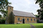
place

Wildon Grange

Civil parishes in North YorkshireUse British English from July 2018
Wildon Grange UK parish locator map

Wildon Grange is a civil parish in the Hambleton district of North Yorkshire, England.

Excerpt from the Wikipedia article Wildon Grange (License: CC BY-SA 3.0, Authors, Images).

Wildon Grange
Mill Field Lane,

Geographical coordinates (GPS) Address Nearby Places
placeShow on map

Wikipedia: Wildon GrangeContinue reading on Wikipedia

Geographical coordinates (GPS)

Latitude Longitude
N 54.195 ° E -1.21 °
placeShow on map

Address

Mill Field Lane

Mill Field Lane
YO61 4AF , Wildon Grange
England, United Kingdom
mapOpen on Google Maps

Wildon Grange UK parish locator map
Share experience

Nearby Places

Husthwaite Gate railway station

Husthwaite Gate railway station is a disused railway station in North Yorkshire, England. It served the nearby village of Husthwaite. When the Thirsk and Malton Line was completed in 1853, there was originally no station near Husthwaite. However, a single platform on the north side of the single line was provided by 1856, east of the crossing with the minor road from Husthwaite to Carlton Husthwaite, known as Elphin Bridge Lane. A stationmaster's house, incorporating the ticket office, was built on the opposite side of the crossing.A goods siding in front of the stationmaster's house was built at the cost of Sir George Wombwell, a local landowner. In 1872, it was taken into public use and Wombwell's outlay was refunded. In 1880, a 200 yards (180 m) tramway was built to connect the goods siding to Angram Wood, north east of the station. This was used to forward timber from Angram to Helmsley for processing. The gauge of the tramway is unknown.In 1856, a single train plied the route between Pilmoor and Malton three times daily. This had risen to four trains a day by 1895. In 1906, services on the line amounted to six trains each way, five of which went south to York and one which ran north to Pilmoor and offered a connecting service via the Pilmoor, Boroughbridge and Knaresborough Railway to Harrogate.The station was closed to passengers in January 1953, but the line was still used by long-distance passenger traffic and excursions. It remained as a goods station but became an unmanned delivery siding from October 1963. The station was closed in August 1964, having latterly been serviced with trains only from the east. An accident in March 1963 on the East Coast Main Line damaged Sessay Wood Junction and it was never repaired. The line was closed in 1964, and the track pulled up in the following year. A brick course of the platform remains. The stationmaster's house is a private dwelling, and the station sidings area is now a campsite.

Kilburn White Horse
Kilburn White Horse

The Kilburn White Horse, grid reference SE516813, is a hill figure cut into the hillside in the North York Moors National Park near Kilburn in North Yorkshire, England. The figure is 318 feet (97 m) long by 220 ft (67 m) high and covers about 1.6 acres (6,475 m2) and said to be the largest and most northerly hill figure in England.Located on the southern flank of Sutton Bank, near Roulston Scar at the edge of the Hambleton table-land, it faces south-south-west and is visible from some distance, particularly from the East Coast Main Line railway south of Thirsk, and from the A19. On a clear day, the horse is visible from north Leeds, 28 miles (45 km) away on the higher ground to the west of the Vale of York. Sutton Bank, geologically, is formed of sandstone and the horse was created by removing the topsoil and exposing the underlying rock and covering it with white limestone chips. It was created in November 1857, and some accounts state that it was done by schoolmaster John Hodgson and his pupils, together with local volunteers. A tablet erected at the car park below it reads, "The Kilburn 'White Horse' -- This figure was cut in 1857 on the initiative of Thomas Taylor, a native of Kilburn. In 1925 a restoration fund was subscribed by the readers of the Yorkshire Evening Post and the residue of £100 was invested to provide for the triennial grooming of the figure." However, Morris Marples in his 1949 book gives Thomas Taylor the credit for being the prime mover: a native of Kilburn, he was a buyer for a London provision merchant. He seems to have attended celebrations at the Uffington White Horse in 1857, and he was inspired to give his home village a similar example. Thirty-three men were involved in cutting it, and 6 tons (6.1 metric tonnes) of lime were used to whiten the exposed rock. Nowadays a car park is provided below the white horse and there is a footpath ascending past it and crossing immediately above it. The image itself is now formed of off-white limestone chips, but the steep gradient of the hillside, especially at the horse's breast and forelegs, have led to slumping and retention boards have been fixed to restrain this. The footpath offers a scenic view. The car park is located on a steeply graded minor road between Kilburn village and the Sutton Bank National Park Centre on the A170 road, and the best view of the white horse itself is from the Bagby road; benches are provided at the best vantage point to allow leisurely observation. During World War II the horse was covered over to prevent it from becoming a conspicuous navigation landmark for enemy bombers. This white horse can reputedly be seen from Julian's Bower, Alkborough in North Lincolnshire, over 45 miles (72 km) away. The horse featured in the launch video for Channel 3 North East, the rebranded version of regional ITV station Tyne Tees Television, in September 1996. The horse was repainted in 2014. The Kilburn White Horse Association, run by volunteers, handed the site to Forestry England in 2018. In 2022, the horse was resprayed at a cost of £20,000.