place

St Michael's Church, Coxwold

15th-century church buildings in EnglandEnglish Gothic architecture in North YorkshireGrade I listed churches in North YorkshireHambleton DistrictUse British English from June 2023
St Michael Coxwold
St Michael Coxwold

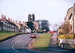
St Michael's Church is an Anglican parish church in Coxwold, North Yorkshire, England. The Parish of Coxwold is part of the Church of England's Diocese of York.The earliest church on the site dates to the Anglo-Saxon period. That church was replaced by a Norman one built in the 11th century, and that in turn was replaced with the present church which was built by 1430. The church is in the Perpendicular style, and among its unusual features are an octagonal tower and a tongue-shaped altar rail. The church is a grade I listed building.The church is the resting place of Rear Admiral Lord Adolphus FitzClarence, an illegitimate son of Prince William, the future William IV, and his mistress Dorothea Jordan.

Excerpt from the Wikipedia article St Michael's Church, Coxwold (License: CC BY-SA 3.0, Authors, Images).

St Michael's Church, Coxwold
Husthwaite Road,

Geographical coordinates (GPS) Address Nearby Places
placeShow on map

Wikipedia: St Michael's Church, CoxwoldContinue reading on Wikipedia

Geographical coordinates (GPS)

Latitude Longitude
N 54.18786 ° E -1.1847 °
placeShow on map

Address

Husthwaite Road
YO61 4AE , Coxwold
England, United Kingdom
mapOpen on Google Maps

St Michael Coxwold
St Michael Coxwold
Share experience

Nearby Places

Husthwaite Gate railway station

Husthwaite Gate railway station is a disused railway station in North Yorkshire, England. It served the nearby village of Husthwaite. When the Thirsk and Malton Line was completed in 1853, there was originally no station near Husthwaite. However, a single platform on the north side of the single line was provided by 1856, east of the crossing with the minor road from Husthwaite to Carlton Husthwaite, known as Elphin Bridge Lane. A stationmaster's house, incorporating the ticket office, was built on the opposite side of the crossing.A goods siding in front of the stationmaster's house was built at the cost of Sir George Wombwell, a local landowner. In 1872, it was taken into public use and Wombwell's outlay was refunded. In 1880, a 200 yards (180 m) tramway was built to connect the goods siding to Angram Wood, north east of the station. This was used to forward timber from Angram to Helmsley for processing. The gauge of the tramway is unknown.In 1856, a single train plied the route between Pilmoor and Malton three times daily. This had risen to four trains a day by 1895. In 1906, services on the line amounted to six trains each way, five of which went south to York and one which ran north to Pilmoor and offered a connecting service via the Pilmoor, Boroughbridge and Knaresborough Railway to Harrogate.The station was closed to passengers in January 1953, but the line was still used by long-distance passenger traffic and excursions. It remained as a goods station but became an unmanned delivery siding from October 1963. The station was closed in August 1964, having latterly been serviced with trains only from the east. An accident in March 1963 on the East Coast Main Line damaged Sessay Wood Junction and it was never repaired. The line was closed in 1964, and the track pulled up in the following year. A brick course of the platform remains. The stationmaster's house is a private dwelling, and the station sidings area is now a campsite.