place

South Main and Washington Streets Historic District

Historic districts in Fairfield County, ConnecticutHistoric districts on the National Register of Historic Places in ConnecticutItalianate architecture in ConnecticutNRHP infobox with nocatNational Register of Historic Places in Fairfield County, Connecticut
Second Empire architecture in Connecticut
Spring Morning Washington Street with Empty Bench

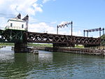
The South Main and Washington Streets Historic District — 68-139 Washington St. and 2-24 South Main St. is a historic district in South Norwalk, Connecticut. The 110-acre (45 ha) district encompasses 35 buildings and two other structures (including the South Norwalk Railroad Bridge). Varied architectural styles from the late 19th and early 20th centuries include Romanesque Revival, Second Empire, and Italianate architecture. Half (5.5 acres (2.2 ha)) of the area first became part of the National Register of Historic Places in 1977 (35 buildings and two structures). The district was increased in 1985 with the addition of nine buildings on 2.5 acres (1.0 ha) (11-15 through 54-60 South Main St.) and again in 1999, with another 10 buildings on 3 acres (1.2 ha), roughly along North Main Street from Washington Street to Ann Street.The original district included 26 contributing buildings and 2 other contributing structures over a 5.5-acre (2.2 ha) area. The district was first increased to add 9 contributing buildings over a 2.5-acre (1.0 ha) area. The second increase added 10 contributing buildings over a 3-acre (1.2 ha) area. The district is a densely packed area, with an 1895 railroad bridge at its "visual center". Its "primary significance" is as "an extensive and cohesive collection of late 19th century and early 20th century commercial structures."

Excerpt from the Wikipedia article South Main and Washington Streets Historic District (License: CC BY-SA 3.0, Authors, Images).

South Main and Washington Streets Historic District
Seaview Avenue, Norwalk

Geographical coordinates (GPS) Address Nearby Places
placeShow on map

Wikipedia: South Main and Washington Streets Historic DistrictContinue reading on Wikipedia

Geographical coordinates (GPS)

Latitude Longitude
N 41.098611111111 ° E -73.406111111111 °
placeShow on map

Address

Seaview Avenue 60
06855 Norwalk
Connecticut, United States
mapOpen on Google Maps

Spring Morning Washington Street with Empty Bench
Share experience

Nearby Places

East Norwalk Historical Cemetery

Established in c. 1655, the East Norwalk Historical Cemetery is Norwalk's oldest cemetery, and many of the area's first settlers are buried there. The cemetery is owned and maintained by the Third Taxing District, formally known as the East Norwalk Fire District of the Town of Norwalk, and before that it was known as the Down Town School District. Triangle shaped and surrounded clockwise by Gregory Boulevard, Cemetery Street and East Avenue it is situated in the neighborhood of East Norwalk. At the north entrance of the grounds stands the First Settlers of Norwalk Memorial, inscribed with the following names of 31 settlers who founded Norwalk in 1649: George Abbitt, Robert Beacham, Stephen Beckwith, John Bowton, Matthew Campfield, Nathaniel Eli, Thomas Fitch, John Griggorie, Samuel Hales, Thomas Hales, Walter Haite, Nathaniel Haies, Rev. Thomas Hanford, Richard Homes, Ralph Keiler, Daniel Kellogge, Thomas Lupton, Matthew Marvin, Sr., Matthew Marvin, Jr., Isacke More, Jonathan Marsh, Widow Morgan, Richard Olmsted, Nathaniel Richards, John Ruskoe, Matthias Sention, Sr., Matthias Sention, Jr., Matthew Sention, Thomas Seamer, Richard Webb, and Walter Keiler. Many graves are unmarked by headstones as remains were deposited before stones were available, and of which no mark or tradition is known. In 1843, the Down Town Cemetery Association was founded to maintain and conduct the business of the cemetery. In 1933, the name was changed to the East Norwalk Cemetery Association. In 1941, the Norwalk Third Taxing District entered into an agreement to supplement the association's perpetual care fund, due to a dwindling amount of donations. In 1966, the district took the deed to the land, so as to secure better insurance. Today, the district provides for the perpetual care of the grounds, while cemetery business is conducted by volunteers of the association.

Norwalk rail accident

The Norwalk rail accident occurred on May 6, 1853, in Norwalk, Connecticut, and was the first major U.S. railroad bridge disaster; 48 were killed when a train travelling at 50 mph plunged into the Norwalk Harbor off of an open draw (swing) bridge.The accident occurred on the New York and New Haven Railroad where it crosses a small inlet of Long Island Sound via a swing bridge. The approach from New York is around a sharp curve, so there was a signal indicating if the bridge was passable by trains: a red ball mounted upon a tall pole. At 08:00 that morning, the Boston express left New York with 200 passengers driven by a substitute driver for whom this was the third transit of the route. The train consisted of two baggage and five passenger cars. On approaching the bridge, the driver neglected to check the signal and only became aware that the bridge was open when within 400 feet (120 m) of it. The bridge had been opened for the passage of the steamship Pacific, which had just passed through. The driver applied the brakes and reversed the engine, but was unable to stop in time. He and the fireman leapt clear before the bridge and escaped serious injury. The engine itself flew across the 60-foot (18 m) gap, striking the opposite abutment some 8 feet (2.4 m) below the level of the track and sinking into 12 feet (3.7 m) of water. The baggage cars came to rest atop the locomotive; the front of the first passenger car was crushed against the baggage cars and then submerged as the second passenger car came to rest on top of it. The third passenger car broke in two; the front half hanging down over the edge of the abutment; the rear remaining on the track. Most of the 48 dead and 30 injured were in the first passenger car. A further eight people were reported missing. Many doctors were travelling on the train, returning from the Sixth Annual Meeting of the American Medical Association in New York; seven of them were killed. Amongst the unhurt was Dr. Gurdon Wadsworth Russell, who wrote an account of the accident for the Hartford Courant in which he says that the dead "presented all the symptoms of asphyxia from drowning, and were probably drowned at once, being confined and pressed by broken cars. Oh, what a melancholy scene that!" As a result of the public panic and indignation caused by the accident, the Connecticut Legislature imposed a law requiring every train in the state to come to a dead halt before crossing any opening bridge. The engineer was charged with gross negligence and held primarily responsible for the disaster. A similar accident occurred eleven years later in Canada with even greater loss of life, the St-Hilaire train disaster.

Norwalk River Railroad Bridge

The Norwalk River Railroad Bridge (also known as the Walk Bridge) is a swing bridge built in 1896 for the New York, New Haven and Hartford Railroad. It currently carries Amtrak and Metro-North Railroad trains over the Norwalk River. The current swing bridge is located at the same site where, in 1853, a train from New York City plummeted into the river while the previous swing bridge was open, resulting in dozens of deaths. In 1896, the New Haven Railroad built the bridge and widened its route to four tracks, as it simultaneously built its South Norwalk Railroad Bridge over the intersection of Washington Street with North Main and South Main streets. The 562-foot (171 m) span, with a rotating swing span 202 feet (62 m) long was provided by the Berlin Iron Bridge Co. This type of swing bridge is one of just two on the Northeast Corridor. The swing span has a rim-bearing system of 96 rollers, allowing tall vessels to pass by. The span is one of only 13 of the company's bridges (and one of only two railroad bridges) that survive in the state as of August 2001. In 1907 the rail line was electrified with overhead catenary wires, which form a prominent feature of the bridge today. It is or was also known as Norwalk River Bridge. It was added to the National Register of Historic Places in 1987.It is one of eight moveable bridges on the Amtrak route through Connecticut surveyed in one multiple property study in 1986. The eight bridges from west to east are: Mianus River Railroad Bridge at Cos Cob, built in 1904; the Norwalk River Railroad Bridge at Norwalk, 1896; Saugatuck River Railroad Bridge at Westport, 1905; Pequonnock River Railroad Bridge at Bridgeport, 1902; Housatonic River Railroad Bridge, at Devon, 1905; Connecticut River Railroad Bridge, Old Saybrook-Old Lyme, 1907; Niantic River Bridge, East Lyme-Waterford, 1907; and Thames River Bridge (Amtrak), Groton, built in 1919. As a single movable span with aging mechanical mechanisms, the Norwalk River Bridge represents a frequent point of failure for Amtrak and Metro-North service and has been targeted for replacement with dual movable spans. The final design approved for the new Walk Bridge calls for a dual-span vertical-lift bridge.