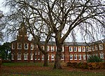
Clyst Heath
1455 in England1549 in EnglandAreas of ExeterConflicts in 1455Conflicts in 1549 ... and 3 more
Heaths of DevonMilitary history of CornwallMilitary history of Devon

Today Clyst Heath is a suburb to the south east of the city of Exeter, Devon, England. An area of relatively high ground to the west of the River Clyst, it remained heathland until the early nineteenth century when it was cultivated for the first time.Two notable battles took place on the heath, in 1455 and 1549. The 1:25000 Ordnance Survey map shows the conventional symbol for both battles at grid reference SX965912, just north of Sandy Park rugby stadium.
Excerpt from the Wikipedia article Clyst Heath (License: CC BY-SA 3.0, Authors, Images).Clyst Heath
Clyst Halt Avenue, Exeter Digby
Geographical coordinates (GPS) Address Nearby Places Show on map
Geographical coordinates (GPS)
| Latitude | Longitude |
|---|---|
| N 50.7115 ° | E -3.4745 ° |
Address
Clyst Halt Avenue 4
EX2 7TQ Exeter, Digby
England, United Kingdom
Open on Google Maps


