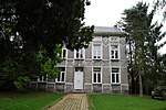
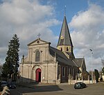
Deftinge
East Flanders geography stubsLierdePopulated places in East Flanders

Deftinge is a village which makes up part of the municipality of Lierde. It is located in the Denderstreek and in the Flemish Ardennes, the hilly southern part of the Belgian province of East Flanders. It was an independent municipality until 1977 when it was merged into Lierde.
Excerpt from the Wikipedia article Deftinge (License: CC BY-SA 3.0, Authors, Images).Deftinge
Ottergemstraat, Lierde
Geographical coordinates (GPS) Address Nearby Places Show on map
Geographical coordinates (GPS)
| Latitude | Longitude |
|---|---|
| N 50.783333333333 ° | E 3.8333333333333 ° |
Address
Ottergemstraat 89A
9570 Lierde
East Flanders, Belgium
Open on Google Maps


