Höhlensteintal
Tyrol geography stubsValleys of South Tyrol

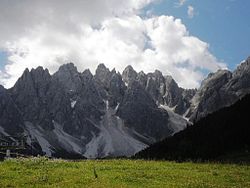
The Höhlensteintal (Italian: Val di Landro; German: Höhlensteintal) is a side valley of the Puster Valley in South Tyrol, Italy.
Excerpt from the Wikipedia article Höhlensteintal (License: CC BY-SA 3.0, Authors, Images).Höhlensteintal
SS51, Pustertal - Val Pusteria
Geographical coordinates (GPS) Address Nearby Places Show on map
Geographical coordinates (GPS)
| Latitude | Longitude |
|---|---|
| N 46.695 ° | E 12.222 ° |
Address
SS51
39034 Pustertal - Val Pusteria
Trentino – Alto Adige/Südtirol, Italy
Open on Google Maps


