place

Hathaway Pines, California

Calaveras County, California geography stubsUnincorporated communities in Calaveras County, CaliforniaUnincorporated communities in CaliforniaUse mdy dates from July 2023

Hathaway Pines is an unincorporated community in Calaveras County, California, 8 km (5 mi) south of Arnold and 20 km (12.5 mi) northeast of Angels Camp. It lies at an elevation of 3323 feet (1013 m). Hathaway Pines' post office was established in 1943; it has the zip code 95233. The place's name honors Robert B. Hathaway, a vacation resort promoter who became the first postmaster.

Excerpt from the Wikipedia article Hathaway Pines, California (License: CC BY-SA 3.0, Authors).

Hathaway Pines, California
Highway 4,

Geographical coordinates (GPS) Address Nearby Places
placeShow on map

Wikipedia: Hathaway Pines, CaliforniaContinue reading on Wikipedia

Geographical coordinates (GPS)

Latitude Longitude
N 38.191944444444 ° E -120.36555555556 °
placeShow on map

Address

Highway 4 5234
95223
California, United States
mapOpen on Google Maps

Share experience

Nearby Places

Stanislaus River
Stanislaus River

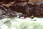
The Stanislaus River is a tributary of the San Joaquin River in north-central California in the United States. The main stem of the river is 96 miles (154 km) long, and measured to its furthest headwaters it is about 150 miles (240 km) long. Originating as three forks in the high Sierra Nevada, the river flows generally southwest through the agricultural San Joaquin Valley to join the San Joaquin south of Manteca, draining parts of five California counties. The Stanislaus is known for its swift rapids and scenic canyons in the upper reaches, and is heavily used for irrigation, hydroelectricity and domestic water supply. Originally inhabited by the Miwok group of Native Americans, the Stanislaus River was explored in the early 1800s by the Spanish, who conscripted indigenous people to work in the colonial mission and presidio systems. The river is named for Estanislao, who led a native uprising in Mexican-controlled California in 1828, but was ultimately defeated on the Stanislaus River (then known as the Río de los Laquisimes). During the California Gold Rush, the Stanislaus River was the destination of tens of thousands of gold seekers; many of them reached California via Sonora Pass, at the headwaters of the Middle Fork. Many miners and their families eventually settled along the lower Stanislaus River. The farms and ranches they established are now part of the richest agricultural region in the United States.Early mining companies were formed to channel Stanislaus River water to the gold diggings via elaborate canal and flume systems, which directly preceded the irrigation districts formed by farmers who sought a greater degree of river control. Starting in the early 1900s, many dams were built to store and divert water; these were often paired with hydro-power systems, whose revenues covered the high cost of the water projects. In the 1970s the construction of the federal New Melones Dam incited major opposition from recreation and environmental groups (documented on the Stanislaus River Archive), who protested the loss of one of the last free-flowing stretches of the Stanislaus. Although New Melones was eventually built, its completion is considered to have marked the end of large dam building in the United States.Water rights along the Stanislaus River are a controversial topic, with the senior rights of farmers coming into conflict with federal and state laws protecting endangered salmon and steelhead trout. The Stanislaus irrigation districts contend that diverting water for fish damages the local economy, especially in years of drought. Water managers have struggled to find a balance between competing needs, which also include groundwater recharge, flood control, and river-based recreation such as fishing and whitewater rafting.

Old mining camp of Brownsville

The site of the Old Mining Camp of Brownsville is a California Historical Landmark on Pennsylvania Gulch Road east of the town of Murphys, California in Calaveras County. The Mining Camp of Brownsville was a California Gold Rush camp in Pennsylvania Gulch in from 1850 to 1870. The camp is named after Alfred Brown, who was the former owner of the Table Mountain Ranch. There were many rich mines in the area and Brownsville Mining Camp supported this activity. So rich was the area, the Brownsville Mining District limited the size of mines in the District. Each miner could claim and own only one wet and one dry site, no larger than 150 square feet (14 m2) each. Brownsville Mining District was in the area of Pennsylvania Gulches and Missouri Gulches 2 miles from Murphys. There are no remains of the camp, but nearby is the Brownsville Mining District Cemetery. A plaque monument was dedicated on July 19, 1953, by California State Park Commission with the monument base built by Christa Parlor No. 137 and Ruby Parlor No. 49 of the Native Daughters of the Golden West.Table Mountain Ranch was 1,300-acre ranch that started a mile east of the city of Murphys and ran to the Stanislaus River. The ranch's was bordered on the west by Coyote Creek. George Brown founded the ranch in the 1850, and supported the gold rush miners. George Brown sold the ranch in 1860 to William. Auditt and George March. In 1882 the ranch was sold to Leo Dolan and again sold in 1889 it was sold to William and Ethel Adams, mining engineer from Boston. After their divorce, William sold the ranch to Ethel's father. Ethel ran the ranch and had a herd of beef cattle, Jersey dairy cows, swine and horses. The ranch also became an orchard with English walnuts, almonds, French prunes, peachas, grapes and apples. Ethel died in 1927 and left the ranch to its foreman, Fred Kenney. Kenney operated the Dairy till 1940. Kenney raised cattle until 1963, in 1963 when Kenney sold the ranch to David Kentfield. Kentfield subdivided some of Ranch. Some Hollywood movies were shot on Table Mountain Ranch including: The County Chairman in 1935 with Will Rogers, The Farmer Takes a Wife in 1935 with Janet Gaynor and Henry Fonda, The Red House in 1947 with Edward G. Robinson, and Seven Brides for Seven Brothers in 1954. Only raimaning building of the ranch is the Dairy barn on 70-acres, that is now the Indian Rock Vineyards at 38.1300°N 120.4381°W / 38.1300; -120.4381.