Garfield Avenue (Los Angeles County)

Garfield Avenue/Cherry Avenue is a major north-south street in Los Angeles County, California, US. The avenue lies between Atlantic Boulevard and Rosemead/Lakewood Boulevard. It begins as Garfield Avenue as a minor street north of Grevelia Street in South Pasadena. It runs through cities like South Pasadena, Alhambra, Monterey Park, Montebello, Commerce, Bell Gardens, South Gate, on way to Paramount before it changes to Cherry Avenue on entrance to Long Beach, Lakewood, and Signal Hill, ending at Ocean Boulevard. Garfield Avenue/Cherry Avenue intersects with the following freeways: Interstate 10, San Bernardino FreewayState Route 60, Pomona FreewayInterstate 5, Santa Ana FreewayInterstate 105, Century FreewayState Route 91, Artesia FreewayInterstate 405, San Diego Freeway
Excerpt from the Wikipedia article Garfield Avenue (Los Angeles County) (License: CC BY-SA 3.0, Authors, Images).Garfield Avenue (Los Angeles County)
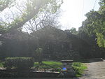
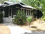
North Garfield Avenue, Pasadena
Geographical coordinates (GPS) Address Nearby Places Show on map
Geographical coordinates (GPS)
| Latitude | Longitude |
|---|---|
| N 34.161243 ° | E -118.143836 ° |
Address
North Garfield Avenue 907
91104 Pasadena
California, United States
Open on Google Maps


