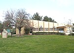
Al-Masmiyya al-Kabira
Arab villages depopulated during the 1948 Arab–Israeli WarDistrict of GazaPages with non-numeric formatnum arguments

Al-Masmiyya al-Kabira (Arabic: المسمية الكبيرة) was a Palestinian village in the Gaza Subdistrict, located 41 kilometers (25 mi) northeast of Gaza. With a land area of 20,687 dunams, the village site (135 dunams) was situated on an elevation of 75 meters (246 ft) along the coastal plain. It was depopulated during the 1948 Arab–Israeli War. Before the war, it had a population of 2,520 in 1945.
Excerpt from the Wikipedia article Al-Masmiyya al-Kabira (License: CC BY-SA 3.0, Authors, Images).Al-Masmiyya al-Kabira
Yoav Regional Council
Geographical coordinates (GPS) Address Nearby Places Show on map
Geographical coordinates (GPS)
| Latitude | Longitude |
|---|---|
| N 31.7575 ° | E 34.784722222222 ° |
Address
7986000 Yoav Regional Council
South District, Israel
Open on Google Maps


