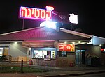
Qastina
All accuracy disputesArab villages depopulated during the 1948 Arab–Israeli WarDistrict of GazaPages with non-numeric formatnum arguments

Qastina (Arabic: قسطينة) was a Palestinian village, located 38 kilometers northeast of Gaza City. It was depopulated during the 1948 Arab-Israeli war.
Excerpt from the Wikipedia article Qastina (License: CC BY-SA 3.0, Authors, Images).Qastina
Beer Tuvia Regional Council
Geographical coordinates (GPS) Address Nearby Places Show on map
Geographical coordinates (GPS)
| Latitude | Longitude |
|---|---|
| N 31.739166666667 ° | E 34.762222222222 ° |
Address
7986000 Beer Tuvia Regional Council
South District, Israel
Open on Google Maps


