Mount Flume
Mountains of Grafton County, New HampshireMountains of New HampshireNew England Four-thousand footers

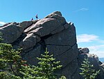
Mount Flume is a 4,328-foot (1,319 m) mountain at the southern end of the Franconia Range in the White Mountains of New Hampshire, United States. Mount Flume is the lowest in elevation of the peaks in the Franconia Range that are accessible by official hiking trails. The summit marks the western border of the Pemigewasset Wilderness within the White Mountain National Forest. From the summit, there are outstanding views of Franconia Notch and the Kinsman Range to the west and the Franconia Range to the north, with limited views of the Pemigewasset Wilderness and the Twin Range to the east.
Excerpt from the Wikipedia article Mount Flume (License: CC BY-SA 3.0, Authors, Images).Mount Flume
Franconia Ridge Trail,
Geographical coordinates (GPS) Address Nearby Places Show on map
Geographical coordinates (GPS)
| Latitude | Longitude |
|---|---|
| N 44.1089549 ° | E -71.6278588 ° |
Address
Franconia Ridge Trail
Franconia Ridge Trail
New Hampshire, United States
Open on Google Maps


