Lyman Street Historic District
Federal architecture in MassachusettsHistoric districts in Middlesex County, MassachusettsHistoric districts on the National Register of Historic Places in MassachusettsNRHP infobox with nocatNational Register of Historic Places in Waltham, Massachusetts ... and 2 more
Use mdy dates from August 2023Waltham, Massachusetts

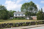
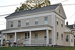
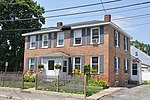
The Lyman Street Historic District is a historic district roughly encompassing Lyman Street between Church and Main Streets in Waltham, Massachusetts. Lyman Street was laid out in 1826 by Theodore Lyman, owner of The Vale, a country estate (now a National Historic Landmark) just to the north. Residential development took place along the street roughly between 1840 and 1900, resulting in a series of fashionable houses in a variety of 19th century architectural styles on the west side of the street. The district was listed on the National Register of Historic Places in 1989.
Excerpt from the Wikipedia article Lyman Street Historic District (License: CC BY-SA 3.0, Authors, Images).Lyman Street Historic District
Church Street, Waltham
Geographical coordinates (GPS) Address Nearby Places Show on map
Geographical coordinates (GPS)
| Latitude | Longitude |
|---|---|
| N 42.378888888889 ° | E -71.231388888889 ° |
Address
John W. McDevitt Middle School
Church Street
02454 Waltham
Massachusetts, United States
Open on Google Maps


