place

Lyddington

Civil parishes in RutlandRutland geography stubsVillages in Rutland
Lyddington
Lyddington

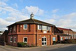
Lyddington is a village in the county of Rutland in the East Midlands of England. The population of the civil parish was 397 at the 2001 census, and had fallen to 366 at the 2011 census.The village's name origin is uncertain. Perhaps, 'farm/settlement of Hlyda' or 'farm/settlement with a noisy stream'. Lyddington Bede House, owned by English Heritage, is a Grade I listed building incorporating parts of a medieval bishop's palace. In 1547 it was seized on behalf of the king from the Bishops of Lincoln and later passed to Lord Burghley. In 1600 part of the palace was converted into an almshouse and it continued in this use until 1930. The remains of the fishponds of the bishop's palace are nearby. St Andrew's Church is also Grade I listed.There are two public houses, The Marquess of Exeter and The Old White Hart.

Excerpt from the Wikipedia article Lyddington (License: CC BY-SA 3.0, Authors, Images).

Lyddington
Church Lane,

Geographical coordinates (GPS) Address Nearby Places
placeShow on map

Wikipedia: LyddingtonContinue reading on Wikipedia

Geographical coordinates (GPS)

Latitude Longitude
N 52.563 ° E -0.709 °
placeShow on map

Address

Church Lane

Church Lane
LE15 9LN , Lyddington
England, United Kingdom
mapOpen on Google Maps

Lyddington
Lyddington
Share experience

Nearby Places

Caldecott, Rutland
Caldecott, Rutland

Caldecott is a village in the county of Rutland in the East Midlands of England. The civil parish population was 256 at the 2001 census increasing to 269 at the 2011 census. It is located about four miles (6.4 km) south of Uppingham and about 4 miles north of Corby in Northamptonshire. The A6003 runs through the village; traffic flow on the bridge over the River Welland is controlled by traffic lights. The village's name means 'cottages which are cold'.Caldecott is the most southerly village in Rutland. It is a small historic ironstone village situated on the A6003. The village has campaigned for a bypass since at least the 1950s, which was approved in 2007 but fell through due to the financial crisis.Otherwise Caldecott is surrounded by rolling countryside and close to the Eyebrook Reservoir nature reserve and Rockingham Forest. Caldecott has a new playground, fundraised for and managed by the local community. The village has an active community, hosting a number of clubs & societies and events, usually at the Village Hall. The parish church of St John the Evangelist, is a Grade II* listed building; it dates back to the 12th century and is a focal point for the village, holding regular services. There is one public house - The Plough Inn - by The Green on Main Street, and an Italian restaurant - Castle Italia - on the A6003 Rockingham Road to the south of the village. There was once a railway station on the southern edge of the village. It was named after the neighbouring village of Rockingham, which was considered to be of more importance at the time. The railway station closed in 1966.