Nieuwe Waterweg

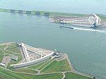
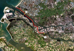
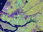
The Nieuwe Waterweg ("New Waterway") is a ship canal in the Netherlands from het Scheur (a branch of the Rhine-Meuse-Scheldt delta) west of the town of Maassluis to the North Sea at Hook of Holland: the Maasmond, where the Nieuwe Waterweg connects to the Maasgeul. It is the artificial mouth of the river Rhine. The Nieuwe Waterweg, which opened in 1872 and has a length of approximately 20.5 kilometres (12.7 mi), was constructed to keep the city and port of Rotterdam accessible to seafaring vessels as the natural Meuse-Rhine branches silted up. The Waterway is a busy shipping route since it is the primary access to one of the busiest ports in the world, the Port of Rotterdam. At the entrance to the sea, a flood protection system called Maeslantkering has been installed (completed in 1997). There are no bridges or tunnels across the Nieuwe Waterweg.
Excerpt from the Wikipedia article Nieuwe Waterweg (License: CC BY-SA 3.0, Authors, Images).Nieuwe Waterweg
Noordzeeweg, Rotterdam
Geographical coordinates (GPS) Address Nearby Places Show on map
Geographical coordinates (GPS)
| Latitude | Longitude |
|---|---|
| N 51.941944444444 ° | E 4.1913888888889 ° |
Address
Noordzeeweg
Noordzeeweg
3151 XS Rotterdam
South Holland, Netherlands
Open on Google Maps


