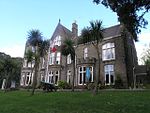
Uplands, Swansea
Communities in SwanseaDistricts of SwanseaUse British English from July 2022

Uplands (Welsh: Pantygwydr) is a suburb and community of Swansea, Wales. It lies about a mile (2 km) to the west of Swansea city centre, and falls within the Uplands electoral ward. It is centred on the A4118 road, which links Swansea city centre and Sketty. The main road begins as Walter Road from the east, and becomes Sketty Road towards the west. Much of the area is hilly. The population of the community and ward in 2011 was 15,665 and in terms of Welsh identity had the lowest percentage in the county.
Excerpt from the Wikipedia article Uplands, Swansea (License: CC BY-SA 3.0, Authors, Images).Uplands, Swansea
St James's Crescent, Swansea Brynmill
Geographical coordinates (GPS) Address Phone number Nearby Places Show on map
Geographical coordinates (GPS)
| Latitude | Longitude |
|---|---|
| N 51.62 ° | E -3.96 ° |
Address
Ffynone House School Trust
St James's Crescent 36
SA1 6DR Swansea, Brynmill
Wales, United Kingdom
Open on Google Maps


