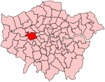
Acton Vale, London
Acton, LondonAreas of LondonDistricts of the London Borough of EalingLondon geography stubsUse British English from August 2015
Acton Vale is a district in London, England. It lies between Acton to the west, and Shepherd's Bush to the east. In 1897 it referred to the stretch of the Uxbridge Road between Acton High Street (starting at the railway bridge) and Askew Road In 1908 it referred to the stretch of the Uxbridge Road between Acton High Street (starting at the railway bridge) and Larden Road
Excerpt from the Wikipedia article Acton Vale, London (License: CC BY-SA 3.0, Authors).Acton Vale, London
Shaa Road, London Acton (London Borough of Ealing)
Geographical coordinates (GPS) Address Nearby Places Show on map
Geographical coordinates (GPS)
| Latitude | Longitude |
|---|---|
| N 51.511 ° | E -0.258 ° |
Address
Shaa Road
Shaa Road
W3 7EX London, Acton (London Borough of Ealing)
England, United Kingdom
Open on Google Maps


