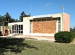
Al-Muharraqa
Arab villages depopulated during the 1948 Arab–Israeli WarDistrict of GazaPages with non-numeric formatnum arguments

Al-Muharraqa (Arabic: المحرّقة) was a Palestinian Arab village in the Gaza Subdistrict, located 14.5 kilometers (9.0 mi) east of Gaza city. The village laid on rolling terrain on the southern coastal plain of Palestine, on a bend in the wadi. It had an elevation of 125 meters (410 ft) and a total land area of 4,855 dunams, most of which was public property, while its built-up area of 29 dunams was Arab-owned. Al-Muharraqa was depopulated during the 1948 Arab-Israeli War.
Excerpt from the Wikipedia article Al-Muharraqa (License: CC BY-SA 3.0, Authors, Images).Al-Muharraqa
Shaar HaNegev Regional Council
Geographical coordinates (GPS) Address Nearby Places Show on map
Geographical coordinates (GPS)
| Latitude | Longitude |
|---|---|
| N 31.466944444444 ° | E 34.611388888889 ° |
Address
מועצה אזורית שער הנגב
Shaar HaNegev Regional Council
South District, Israel
Open on Google Maps


