place

Umm el-Qanatir

8th-century disestablishments in the Umayyad CaliphateAncient Jewish settlements of the Golan HeightsAncient synagogues in the Land of IsraelClassical sites on the Golan HeightsCommons category link is locally defined
Establishments in the Herodian kingdomFormer populated places in the Golan HeightsIsrael National Heritage SiteJews and Judaism in the Roman Empire
אום אל קנאטיר 2
אום אל קנאטיר 2

Umm el-Qanatir, also spelled Umm el-Kanatir (Arabic: ام القناطر, romanized: Umm al-Qanāṭir, lit. 'mother of the arches'), also known as Ein Keshatot (Hebrew: עין קשתות, lit. 'spring of the arches'), is an archaeological site on the Golan Heights, whose main phase is dated to the mid-5th–8th centuries. Excavations have revealed a Roman-period settlement, first inhabited by pagans and later by Jews, who left behind the ruins of an exquisite synagogue when they abandoned the town after it being destroyed by the catastrophic 749 earthquake. The site is located 10 kilometres east of the Dead Sea Transform, one kilometre southwest of Natur.Identification attempts based on Jewish sources have led to two possible ancient names: Kantur, mentioned by Rabbi Menachem di Luzano in his book Ma'arikh (16th/early 17th century); and Qamtra, the name of a place mentioned in the Talmud and with a Jewish past dating back to the Byzantine period.

Excerpt from the Wikipedia article Umm el-Qanatir (License: CC BY-SA 3.0, Authors, Images).

Umm el-Qanatir
Syrian Bridge, Golan Regional Council

Geographical coordinates (GPS) Address Nearby Places
placeShow on map

Wikipedia: Umm el-QanatirContinue reading on Wikipedia

Geographical coordinates (GPS)

Latitude Longitude
N 32.8497 ° E 35.737827777778 °
placeShow on map

Address

אום אל קנטיר

Syrian Bridge
Golan Regional Council
North District, Israel
mapOpen on Google Maps

אום אל קנאטיר 2
אום אל קנאטיר 2
Share experience

Nearby Places

Gergesa
Gergesa

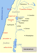
Gergesa, also Gergasa (Γέργεσα in Byzantine greek) or the Country of the Gergesenes, is a place on the eastern (Golan Heights) side of the Sea of Galilee located at some distance to the ancient Decapolis cities of Gadara and Gerasa. Today, it is identified with El-Koursi or Kursi. It is mentioned in some ancient manuscripts of the Gospel of Matthew as the place where the Miracle of the Swine took place, a miracle performed by Jesus who drove demons out of a[matthew 8:28 says 2 men (not one), messianic translation,Jewish bible;kda] possessed man and into a herd of pigs. All three Synoptic Gospels mention this miracle, Matthew writes about two possessed men instead of just one, and only some manuscripts of his Gospel name the location as Gergesa, while the other copies, as well as all versions of Luke and Mark, mention either Gadara or Gerasa (see Mark 5:1-20, Luke 8:26-39, Matthew 8:28-34). The "Gerasa" reading is problematic, because Gerasa is neither near a sea nor does it border Galilee.Some are of the opinion that Gergesa was the country of the ancient Girgashites; but it is more probable that 'Gergesenes' was introduced by Origen upon mere conjecture; as before him most copies seem to have read 'Gadarenes', agreeable to the parallel passages and the ancient Syriac version. In any event, the "country of the Gergesenes/Gadarenes/Gerasenes" in the New Testament Gospels refers to some location on the eastern shore of the Sea of Galilee. The name is derived from either a lakeside village, Gergesa, the next larger city, Gadara, or the best-known city in the region, Gerasa. It is likely that the "Gerasa" reading is erroneous and a copyist error for "Gergesa," since only the latter place is bordering a lake while Gerasa is very far away from a lake.