place

Sycamore Dale

1839 establishments in VirginiaAmerican Civil War sites in West VirginiaBuildings and structures in Romney, West VirginiaGreek Revival houses in West VirginiaHampshire County, West Virginia, in the American Civil War
Houses completed in 1839Houses in Hampshire County, West VirginiaHouses on the National Register of Historic Places in West VirginiaNational Register of Historic Places in Hampshire County, West VirginiaPlantation houses in West Virginia
South Branch River Road entrance to Sycamore Dale

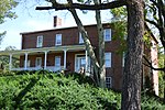
Sycamore Dale (also known as the Gibson-Wirgman-Williams House) is a 19th-century Greek Revival plantation house overlooking the South Branch Potomac River southwest of Romney, West Virginia. Sycamore Dale is one of several historic estates along South Branch River Road (County Route 8). It was listed on the National Register of Historic Places on December 2, 1980.

Excerpt from the Wikipedia article Sycamore Dale (License: CC BY-SA 3.0, Authors, Images).

Sycamore Dale
South Branch River Road,

Geographical coordinates (GPS) Address Nearby Places
placeShow on map

Wikipedia: Sycamore DaleContinue reading on Wikipedia

Geographical coordinates (GPS)

Latitude Longitude
N 39.3375 ° E -78.773333333333 °
placeShow on map

Address

South Branch River Road 2
26757
West Virginia, United States
mapOpen on Google Maps

South Branch River Road entrance to Sycamore Dale
Share experience

Nearby Places

Fort Pearsall
Fort Pearsall

Fort Pearsall was an early frontier fort constructed in 1756 in Romney, West Virginia (then known as Pearsall's Flats, Virginia) to protect local settlers in the South Branch Potomac River valley against Native American raids. The area around present-day Romney had been settled as early as 1725 by hunters and traders in the valley. Fort Pearsall was originally erected as a log house with a stockade by Job Pearsall (Pearsal or Pearsoll) and his brother John on their plantation in an area between Indian Mound Cemetery and the South Branch Potomac River near the river crossing of the old Fort Loudoun Road (Northwestern Turnpike) to Winchester in 1738, according to tradition. However, a look at when forts were built in the region indicates that the fort was likely built when a fort was really needed; in 1755 in the aftermath of the failed Braddock campaign in the opening days of the French and Indian War. Possibly, Job Pearsall and his brother John constructed the stockade to protect the settlers of Pearsall's Flats and the South Branch Potomac Valley. The brothers also constructed a number of homes for settlers that same year. Pearsall’s stockade was provisioned as a fort for the Virginia Regiment, a bona fide military force raised by the colony, by George Washington in 1755 and garrisoned in 1756. The fort came under the command of Captain Robert McKenzie during the French and Indian War. Fort Pearsall was garrisoned at various times during the war until 1758. At around 1758, there were at least 100 people living in the general area of Pearsall's Flats, though this can't be verified by historical records. The number seems suspect unless the "general area" includes the South Branch River Valley eight miles south to The Trough and some 15 miles to the north at the confluence with the North Branch Potomac River. After the hostilities in the area, Thomas Fairfax, 6th Lord Fairfax of Cameron recognized the fact that more settlers would be interested in moving into the South Branch Potomac Valley and that he would gain substantial revenue from the sales of plots of land in the Pearsall's Flats vicinity. Lord Fairfax sent a survey party to Pearsall's in 1762 to formally lay out the town into 100 lots. Lord Fairfax then renamed the town Romney in honor of the Cinque Ports city on the English Channel. Some confusion ensued for several decades concerning the ownership of land within the town as counterclaims were made by the original settlers and those who purchased lots laid out by Lord Fairfax's surveyors. According to oral tradition, Pearsall's Fort was garrisoned again in 1774 for Lord Dunmore's War, however, it cannot be documented in the historical records. Today, a marker stands in Indian Mound Cemetery by the "Yellow Banks" overlooking the South Branch commemorating Fort Pearsall. Alongside the marker is a pile of what are thought to be remnants of the old fort.

Confederate Memorial (Romney, West Virginia)

The Confederate Memorial (also referred to as the First Confederate Memorial) at Indian Mound Cemetery in Romney, West Virginia, commemorates residents of Hampshire County who died during the American Civil War while fighting for the Confederate States of America. It was sponsored by the Confederate Memorial Association, which formally dedicated the monument on September 26, 1867. The town of Romney has claimed that this is the first memorial structure erected to memorialize the Confederate dead in the United States and that the town performed the nation's first public decoration of Confederate graves on June 1, 1866. The idea to memorialize the Confederate war dead of Hampshire County was first discussed in the spring of 1866. Following the decoration of the graves that summer, the Confederate Memorial Association engaged in fundraising for construction of the memorial, and by 1867 the necessary funds were raised. The inscription The Daughters of Old Hampshire Erect This Tribute of Affection to Her Heroic Sons Who Fell in Defence of Southern Rights was selected, and the contract for the memorial's construction was awarded to the Gaddes Brothers firm of Baltimore. The memorial's components were delivered to Indian Mound Cemetery on September 14, 1867, and the memorial was dedicated on September 26 of that year. The construction of the Confederate Memorial marked the beginning of an era of post-war revitalization for Hampshire County following the American Civil War. The memorial comprises a base with obelisk and capstone, standing on a raised mound. The list of 125 names engraved on the monument includes four captains, seven lieutenants (one of which was a chaplain), three sergeants, and 119 privates. The memorial underwent a restoration in 1984, and is decorated annually with a handmade evergreen garland and wreath on Hampshire County Confederate Memorial Day.

Wilson-Wodrow-Mytinger House

The Wilson-Wodrow-Mytinger House is a complex of three structures, built between the 1740s and 1780s, in Romney, West Virginia. The clerk's office, dating from the 1780s, is the oldest surviving public office building in West Virginia. The kitchen building (c. 1750) is the oldest remaining component of the Wilson-Wodrow-Mytinger House and the oldest building in Romney. Throughout its history, the Wilson-Wodrow-Mytinger House has been known as the Andrew Wodrow House, the Mytinger Family Home, and the Mytinger House.The earliest person recorded residing on Lot Number 48 in Romney was Hugh Murphy. In 1763, Colonel George William Wilson received a patent to Lot Number 48 from Thomas Fairfax, 6th Lord Fairfax of Cameron, to purchase the lot from Murphy. Wilson served in the Hampshire County militia as a major during the French and Indian War. He relocated to Pennsylvania, and in 1770, George Washington spent the night in a log cabin on the northeastern corner of Lot Number 48. Andrew Wodrow arrived in Hampshire County near or after the end of the American Revolutionary War. In 1782, Wodrow became clerk of court for Hampshire County. He completed the clerk's office building in the 1780s, and the complex assumed its current configuration by 1790. Wodrow served as Clerk of Court for Hampshire County until his death in 1814, after which ownership passed to Wodrow's son-in-law, John McDowell; a Dr. McClinoch; and the Mytinger family, who retained the property for about 100 years. Manning H. Williams purchased the house and restored it in 1962. Dr. Herbert P. Stelling purchased the Wilson-Wodrow-Mytinger House in 1973, and it opened as a museum and an arts and handicrafts shop known as Colonial Craftsmen. While under the Stelling family's ownership, the house was listed on the National Register of Historic Places in 1977. Its current owners, Old Hampshire Ltd., purchased the Wilson-Wodrow-Mytinger House in 1985.