Pont de Bornègre

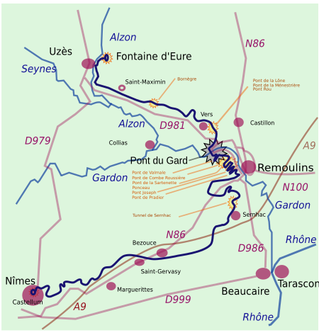
The Pont de Bornègre (or Pont de Bordnègre) is an ancient bridge of the Roman aqueduct to Nîmes, which also includes the famous Pont du Gard, between the communes of Saint-Maximin, and Argilliers. It is located at the upper reaches of the approximately 50 km long aqueduct, 6,745 m downstream of the Eure source and 9,061 m upstream of the Pont du Gard. The structure bridges an intermittent torrent, the Bordnègre, with a catchment area of 0.6–0.8 km2 and, according to modern estimates, a maximum flood flow of 5 m3/s water.Its three segmental arches, with a total span of 17 m, are built of voussoirs covering the whole breadth of the bridge. Today, two of them are buried by sediments up to the springing line of the vaults. After the aqueduct fell into disrepair during the Middle Ages, the Bornègre Bridge, like its big sister across the Gard, was used as a conventional bridge for foot traffic.
Excerpt from the Wikipedia article Pont de Bornègre (License: CC BY-SA 3.0, Authors, Images).Pont de Bornègre
Pont de Bornegre, Nîmes
Geographical coordinates (GPS) Address External links Nearby Places Show on map
Geographical coordinates (GPS)
| Latitude | Longitude |
|---|---|
| N 43.98375 ° | E 4.4758333333333 ° |
Address
Pont de Bornegre
Pont de Bornegre
30210 Nîmes
Occitania, France
Open on Google Maps


