Cap Gris-Nez
Chalk landformsHeadlands of FranceLandforms of Hauts-de-FranceLandforms of the Pas-de-Calais

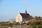
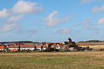
Cap Gris-Nez (literally "cape grey nose"; Koap Zwartenesse (West Flemish)) is a cape located in Audinghen, a commune of the Pas-de-Calais département in northern France. Part of the Cote d'Opale, it is classified as a protected natural area. The cliffs of the Cape are the closest point of France to England, 34 km (21 mi) from their English counterparts at Dover.
Excerpt from the Wikipedia article Cap Gris-Nez (License: CC BY-SA 3.0, Authors, Images).Cap Gris-Nez
Route du Cap, Boulogne-sur-Mer
Geographical coordinates (GPS) Address Nearby Places Show on map
Geographical coordinates (GPS)
| Latitude | Longitude |
|---|---|
| N 50.870833333333 ° | E 1.5836111111111 ° |
Address
Route du Cap
62179 Boulogne-sur-Mer
Hauts-de-France, France
Open on Google Maps


