Ballagarraghyn
Isle of Man geography stubsIsle of Man stubsRoads in the Isle of ManUse British English from February 2017
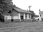
Ballagarraghyn (Manx: [baləˈɡɑɾəxən], "farm of O'Dorchan's") is a farm situated between the 7th milestone and 8th Milestone road-side markers on the primary A1 Douglas to Peel road in the parish of German in the Isle of Man.
Excerpt from the Wikipedia article Ballagarraghyn (License: CC BY-SA 3.0, Authors).Ballagarraghyn
Peel Road, German
Geographical coordinates (GPS) Address Nearby Places Show on map
 Continue reading on Wikipedia
 Geographical coordinates (GPS)
| Latitude | Longitude |
|---|---|
| N 54.200277777778 ° | E -4.6230555555556 ° |
Address
Peel Road
Peel Road
German
Isle of Man
Open on Google Maps